Sunday, January 5, 2014

Escalante Hike: Lick Wash, No Mans Mesa, Park Wash

Lick Wash to No Mans Mesa,
Park Wash Return
~11 miles, 6.5 hours

*

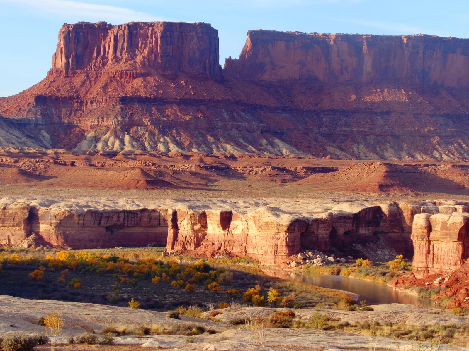
Tom led us on a great hiking loop in Escalante National Monument, which would take us through slot canyons of Lick Wash up to the base of a flat plateau known as No Mans Mesa, with a possible return hike down Park Wash to make a satisfying loop, albeit including some unknown bushwhacking.
With many stunning hiking options in the area, this one would put us into lesser-visited terrain.  I love alternative/less-popular hikes with a bit of exploration and less crowds, and knowing Tom, I think he's even more averse to popular hikes than I am.  As it was, we didn't see a single other person all day.

First things first, though...the scenery of Lick Wash came quickly.


We also realized that snow would be present at the depths of these heights, below the shaded canyon walls.  Many sections would have made decent XC skiing, but many more wouldn't, so hiking boots (or running shoes with holes in them, in my case) were practical options.

I slowed us down a bit more for pictures, none of which can do the canyon justice.


By afternoon, the terrain and sunshine opened up, for a very pleasant day.  We were plenty warm except for slightly wet feet.

We found a mud cave on the side of one of the canyon walls, and decided to explore.


It actually opened up as a straight climb up a hole 10 feet above, onto a higher shelf.  Much better to discover this from below than by accident from above!  We were careful on nearby terrain to avoid unsupported soil.


At the widening confluence with Park Wash, we took a lunch break below a towering sandstone wall. Soft, beachy sand makes this a great place to rest (and, in another trip report, to make camp).


Or build a cabin.  Shortly thereafter, we explored this abandoned cabin.  The cabin itself is a geocache, and I suppose would come in handy if bad weather/flash floods moved in.


We gazed up toward No Mans Mesa, where a supposed goat trail led to the top, 1200' above us.  The trail was supposedly roughly defined and sketchy, as the only break in the cliffs.  In fact, the inaccessibility means that the top has a variety of native grasses and other plants that have been largely undisturbed from grazing or human influence.


But any potential access was still covered in snow, so we pressed on with remaining daylight, on nearly the shortest day of the year, to complete the loop.


We proceeded north below white cliffs, and as sunset approached, pink cliffs glowed above us.


We skirted a marsh, and then hoped for a passage to the west that would lead us back to the road.  Fortunately, past the marsh and the termination of another canyon to the west, we followed an old road (not shown on our map) as it climbed up to the ridge.  The terrain to the southwest/west seemed manageable, through trees with little downfall and occasional but obvious gullies, so we were able to dead-reckon for about half an hour with a satisfying bushwhack back to the road, where cold feet finally warmed up while walking on solid ground for the first sustained amount of time all day.


We got back to the car right at dusk, perfect timing for the road to be just hard enough (it likely would have been muddier earlier in the day) to make the drive back out.  This was a great loop hike with quite a variety of terrain.

Kanab, Utah

J and I had a great, quick trip to Kanab, Utah, right before Christmas. 
We visited and stayed with my friend Tom, whom I worked with in San Diego, and who has a great working knowledge of the area, having visited numerous times to volunteer and adopt dogs from the Best Friends Animal Sanctuary.


After we arrived, we took a shorter hike on the Squaw Trail, giving great views of the surrounding area.
This was also our first time meeting Tom's partner Vicki, who's warmth and friendliness was immediately apparent.  Later, her strong hiking skills and excellent cooking would also become apparent.


Coming up on the weekend, we only had two full days out there, but packed them with some great hikes, followed by great dinners and sharing of Western beer and wine.  Tom had brought his collection of electric Lego trains, and already had a nice setup of 2 trains going.  Later, we expanded that to a record of 3 trains, with some hills and banked corners.


Tom and Vicki were fantastic hosts and great company.  I took a few shakeout jogs on the roads around Kanab, but otherwise we had two days of solid hiking.

Friday, January 3, 2014

Aspen Four-Mountain Skin

Aspen Four-Mountain Skin: Uphill/Downhill Ski
Ajax (Aspen) Mountain
Snowmass
Buttermilk
Aspen Highlands

*

With a conference in the Snowmass/Aspen area, and decent snow and weather, I was anxious to get in my first downhill skiing of the season.  But with the high-cost of lift tickets, and a short but pleasant window of opportunity to get outside each day, it made much more sense to hike up each day.

Since many ski areas (especially in Colorado), operate on public National Forest land, general public use is granted when it can safely coincide with downhill skiing.  The fee paid for downhill skiing at resorts, in fact, is actually a fee paid for an uphill lift ticket...mostly.  Clearly, the benefits of grooming, avalanche control, and the implicit safety of buildings and nearby patrol (even if not used) are also benefits for the uphill user.  At the same time, it would be unusual and unfair to block completely access of our public lands for nearly half the year.  So uphill skiing and hiking is becoming more popular, but it's a tenuous balance of use that is constantly being re-evaluated. 

Fortunately, Aspen has generally liberal and open uphill skiing rules.  And, it has four mountains! The rules vary per mountain, with Snowmass being the most generous (pretty much any trail, all day) to Ajax and Highlands restricting uphill use to non-lift hours.  With some planning, I could skin and ski each of the four mountains that circumscribed the area.

Ajax
First up was Ajax, which permits uphill access only before the lifts run.  This would be a good morning run before my afternoon meetings.  This was also the coldest morning, and one in which I "camped" in my Subaru the night before (after taking a short night XC tour at the Aspen golf course).  My wife's 0-degree bag was warm enough, but it was a stiff and cramped awakening to get up and put ski gear on.  Without overnight parking in Aspen, I caught one of the earliest buses back into town, walked over to the ski area, ready to head up at around 6:20AM.  I didn't really have an idea of pace except remembering taking less than 2 hours at a moderate pace on Snowmass previously, but wanted to be conservative so as not to have to turn around close to the top.


I made my way up slowly but steadily by headlamp, with the clear view of stars giving way to a brightening sky and finally some welcomed sunshine.  I still kept my headlamp on (and a blinky rear reflector) for visibility of any patrol/resort workers, and the ones that went by generally nodded and waved.
"America's Uphill" course was supposed to be marked, but I didn't see such markings.  Still, I stopped a few times for map-checks and followed the listed directions, which are the most sensible and logical uphill runs based on terrain and visibility anyway.

I made my way to the Sundeck at 11,212', with plenty of time to spare, taking something like 1:40-1:45 in a walking/hiking shuffle.  I was pleased to see that it was open, so I warmed up a bit as I switched into dry clothes.


2 other uphillers took brief turns by the fire.  Otherwise, the Sundeck was filled with staff getting ready for the day, turning on the radio and sharing some laughs.  I never know what to expect from staff when you're on the mountain "for free" so I try to lay low, but to a person, they were all friendly, with some asking how the ski was.   Ironically (or idealistically), I think we share a bit more when I'm grateful to sit by the fire but don't really "expect" anything; that is, I'm not going to have an ego about status and I'm clearly happy to be there sharing the mountains that we all love.  This was the first into several glimpses of Aspen where my former views softened in appreciation of some of the people in the area that still do salvage a bit of its soul.

I had plenty of time to warm up and eat a few snacks, so now it was time for the downhill.  For better skiers than myself, and true backcountry, the uphill effort pays off on fresh powder tracks.  For me, still practicing telemark technique and shaking off summer rust, and with no fresh powder to be found anyway, I stuck pretty much to the same blue groomers I skied up, more of a denouement after the more adventurous and committing uphill task.   But, the ability to ski down a quiet, empty slope is worth much more than the price of admission.

With frozen toes, I was thinking about how I was only an hour or so away from a hot shower and coffee, but was pleasantly surprised when free coffee was handed out at the bottom.

Snowmass
With a break during the next afternoon, it was time to head up Snowmass, which allows all-day uphilling.  This was much more pleasant in the full afternoon sun, where short-sleeves were comfortable.


Sticking to the far shoulder, it takes a bit more attention to watch for downhill users, mostly snowboarders that want to hit tiny jumps on the edge, or new skiers that look at you and inevitably head for the direction of their gaze, but it was another pleasant, slow-but-steady hike.  I never really shuffle-jog like racers do, and probably carry too much weight in my pack, and it took about the same time (~1:45) as Ajax the previous day.  So, the rough rule of thumb of 2k-feet/hour was becoming my shuffling benchmark.

There's no "required" route, but I've been up Snowmass several times now, and I always go Village Express->Lunchline->Max Park->Sneaky's, which was a route suggested to me before and plays out well, as the upper blue runs get steeper whereas cutting across on the greens is more steady and gets a bit more afternoon sun as well.

This puts me at the top of Big Burn at 11,835'.  This is the top of the front side of the mountain.  There is more terrain in the Cirque above which was just starting to open.  I hiked up a bit through the backcountry gate for some great views, although the wind had scoured it a bit up there.


Again, I had a pleasant cruise down, this time leading directly to the hotel, leaving plenty of time to get changed and ready for my upcoming presentation, with which I was pleased.

Snowmass-Aspen Owl Creek XC

The next afternoon, Friday, left me with another window of ski-pportunity.  However, the other 2 Aspen resorts weren't opening until the next day.  As planned, I took my skinnier skis instead from Snowmass-Aspen, which was another exploratory tour I had been looking forward to, at somewhere around 9-10 miles one-way, with my goal being leaving directly from the hotel in Snowmass and ending in downtown Aspen, with the ability to take the free shuttle bus back.
This brought back pleasant memories of mountain biking the Government Trail between the towns several years ago with Caleb -- the whole area is beautiful and it's a classic mt. biking trail, so it would be rewarding to traverse some of the same terrain (albeit lower on the hill) on skis.

The Owl Creek Trail also goes between the two towns, with the Owl Creek Chase being an annual race on the groomed trail.  To get to the Owl Creek Trail while avoiding roads, I needed to find some other connection.  I chose to use the Tom Blake trail, by uphill skiing from the Elk Camp area before cutting across on Vista and then Tom Blake.  Tom Blake is normally a summer trail, so having a summer trail map was moderately helpful.  Still, I had some trouble and wasted some time finding it, breaking trail and bushwhacking a bit, noticing later that the summer trail signs near the ski area are removed/turned around to prevent confusion.
Eventually I ended up on a pleasant, rolling backcountry trail, which goes between hillside houses, before making it over to the Two Creeks area.  I took some groomed, empty downhill runs (I'm not even sure where or what they were on the map), which then intersected clearly with the signed Owl Creek Trail.


I was worried that Owl Creek would be too close to the road to be enjoyable, but it was mostly out of sight and noise anyway, so it was a pleasant jaunt amongst hillside meadows.  Then I reached the Buttermilk Ski area, which was gearing up for the opening.  I made my way across and down to the Tie Hack area and unmistakable bridge, on some of the same trails near the rec center (with free wi-fi) and golf course that I had night-skied a few nights earlier.

It would have been sufficient to go to one of the bus stops here, but I made my way further on some of the bike path trails and another lovely bridge, past the mining museum and some stone cottages, before skidding on icy sidewalks and then finally walking to a bus stop.

Buttermilk
Saturday afternoon brought me my first chance to ski Buttermilk, on opening day no less.  Having already explored the Tie Hack area, I started from the main and lowest lift area, following the clearly-marked uphill route.  With right around 2k gain, this took me around an hour -- Buttermilk has the easiest, most gentle terrain in Aspen...but just might have the best views on top.  Definitely a pleasant area (even on opening day!) that I'd recommend for beginners and families.


I met another couple on top who had skinned from West Buttermilk, a higher  (but-further-from-the-road) base area and were planning on laps.  With plenty of time, I skied down this area and made a few laps as well.  This was a quicker uphill-to-downhill payoff, and now meant I had checked out all 3 sides of the mountain.  After a few laps here, I headed back down to the base, enjoying sunset views and open, solo skiing.


Approaching sunset, I made the drive out past Carbondale to Penny Hot Springs, for a free, natural soak under the stars.  No pictures to do it justice, although the waxing moon illuminated the rock formations above, and there was just enough water to lie back and watch the stars above.

Aspen Highlands
The final morning left me with the biggest vertical challenge of Highlands.  This was an additional challenge because of sleeping in the car and catching an early bus again, but also the necessity to be up the mountain before the lifts run.  I've skied down Highlands before and know that it gets steep and narrow in places, so I wanted to make sure I had enough time.


As the sun rose, lighting up puffy cotton candy clouds above me, I had an incredible sight and experience.  The camera certainly could not catch this, but I could see the faint pink and blue hue reflected on the snow below.  It was very faint, but distinct.  As the clouds moved and the sun rose, the colours danced on the snow.  Amazing.


The uphill rules state that uphillers must be beyond the Merry-Go-Round restaurant by 9am.  I had made this benchmark, but the signs actually say something like "No Uphill Traffic past 9am", making it ambiguous as to whether I would have to turn around right at 9am before the summit.  I should have enough time (and did) but didn't want to risk it.  At 8:30, the lifts were whirring and I saw people on them, but this was patrol and staff.   I made it to the top 10 minutes later...greeted by happy and playful avalanche dog, who was quite pleased to fetch his tennis ball that was solidly encased in frozen slobber.


I stayed out of the way of the patrollers and changed quickly in the public bathroom in the patrol hut, and then got ready for the descent before the crowds came.
Having gotten up early, I would have been in prime position to hike to the top of Highlands Bowl.  The main problem with this is that I am not good enough to ski that terrain.  Perhaps I should spend more time downhilling.


Aspen Four-Mountain Skin
So a purist might hike to Highlands Bowl and The Cirque at Snowmass for the ultimate vertical.  I am content with hiking to the lift-served, frontside-top of each of these mountains, with an extra few laps at Buttermilk to give a more satisfying gain.

It was nice to have a window of opportunity to do all four of these mountains.  I am sure that people living in the area do this more frequently and quickly.  In fact, the Aspen Power-of-Four ski mountaineering race goes up all four mountains...in the same day.  And traverses between them for more than a marathon-distance of skiing.  Incredibly, the winners can finish around 5 hours...which is less than the aggregate time I took to get up all 4 mountains, on separate days.  This makes their effort even more tangible, where I can better appreciate their incredible skill and training (most of the contribution) and gear (also helps).  At my level, a couple hours of inefficient but steady uphill is a good workout.

About the only shared realization is just how satisfying it is to ski up and down the mountains under one's own power.  That is a beautiful challenge in itself, which is highly recommended!

Tuesday, December 3, 2013

'Til Next Time, Fort -- Part Deux

Seems like I need some sort of transition before moving on to blogging about nonsense from a new locale.

So we're settled into Golden, now -- Denver West, actually, on the border of Denver and Golden.  And Denver West, actually, is itself a registered trademark (since 1982), as I learned via the circled "R" on some park benches I saw the other day.

But I digress.   J has a new job in Lakewood, which is a great opportunity for her, and so moving south made sense for both of us, to also make it easier for me to get to the Anschutz campus.

We left Fort Collins once before, for just under a year, before moving back -- who knows if it will happen again.  We absolutely love the town, the community, and our friends.  It is the first time, having lived in 4 different states together and twice as many towns, and a strange feeling, to be missing out on the present and future of the city.  We've both worked and volunteered in various capacities in the community, and feel like we've had a great stake in it's successes and challenges.  We've put a lot of work and pride into the town, and into our first home.  I've put thousands of miles of shoe and bike-rubber all over the city -- I'm unaware of any roads or natural areas I haven't visited.  We've watched countless sunsets from our patio, and numerous sunrises from the dams or Horsetooth Rock -- the latter of which has traces of my blood on it.  No other place is more integrated into our history and identity than Fort Collins.
 
The community involvement, and especially things like the bicycling infrastructure and school involvement (albeit with the normal Colorado challenges of funding) are exemplary.  
Unfortunately, job prospects for 21st-century careers in biotech and health analytics (e.g.) are better in the Boulder and Denver area.  I hope that Fort Collins can attract and maintain major employers in those areas, and the ability to utilize a young, talented workforce remains the major challenge. 

That is only to explain our reluctant and perhaps temporary leaving of Fort Collins.  Otherwise, we are fortunate to have made lifelong memories and friendships.  With family still in town, including my favourite niece, we'll undoubtedly be back regularly.  And we're renting out our condo, which is also a reward in itself.  

As for a running standpoint, there's much I'll miss.  Definitely many of the trails, rocky or paved, and many of the workouts, like Jane's Tuesday morning or Towers (umm, maybe not as much lately) and my favourite bar, the Trailhead.  But mostly, the people: genuinely good folks that have given me good reason to get up early, stay up late, and trudge through all kinds of weather.  Everyone's too numerous to name, and that feeling is quite a blessing.

So I'll miss you all, Fort Collins!  But we'll be seeing you around.

Thursday, November 21, 2013

Snow Bike, Fatbike, Ice Bike: What's in a Name?

The epic Front Range Winter of 2006-07 

Today's taste of winter reminded me of confusing winter bike nomenclature.
Here are some facts.

Snow Bike
There is a thing called a snowbike:

Generally and historically, it has one or two skis, and is also known as a "ski bike."
The original (and registered trademark) snowbike is found at the Austrian website for snowbike http://www.snowbike.com
As the top google search, one of the bikes is noted for it's best all-around FahreigenschaftenIt pleases me to know this word exists for "handling characteristics."
But speaking of translations, it seems this should have been called a ski bike only.  It's not a bicycle!  At least, there's nothing "cycle" about it.
There are versions with a rear wheel, but the double-ski version are mostly used on ski slopes at resorts.  I can see the use for those with limited mobility to get down the hill for sure: rock on.  But otherwise they lack the Fahreigenschaften and full-body workout and flow of real skis (I imagine, without actually trying them), and they take up extra space on ski lifts.  Mostly, it is annoying because the "snowbike" set off an avalanche of suboptimal bike-naming.

Skiing and biking together...I prefer this way instead:

*
Ice Bike
So what about people that want to ride or commute in the snow?  A good way to do this is with the increased traction of studded tires.
With "snow bike" taken, these bikes became known as ice bikes, which certainly are better for riding on ice, although riders are generally more enthusiastic about riding on snow.  And we generally call studded car tires snow tires instead of "ice tires."

Here are some folks riding ice bikes in Poland:


Many good products, projects and inspiration is described on http://www.icebike.org/
I spent a few hours and a box of screws a few years ago making my own studded tires.  They worked great on packed snow and ice.  Otherwise, I was terrified about having to fix a flat by peeling off a stiff, spiky tire in the cold; or causing a flat because of all those screws pushing back in against the tube while riding on pavement.  And the tires were heavy!  It was a fun project to do once.
Commercial tires like Nokians seem like a more reliable bet, and it would be even more convenient to have an extra set of rims to swap as necessary.

While wider tires are generally better, I would argue that there are some very specific snow conditions (grippy, wet snow -- e.g. a sunny afternoon just after the cold front passes through) in which road bike tires slice through the snow instead of floating like fat tires do.

*
Fatbikes
But what about deeper, powdery snow, and trail riding? 
This is where fatbikes come into play.  These are bikes with extra wide tires.  Extra wide tires require extra-wide rims...which require extra-wide forks and brake clearance.  And an extra-wide garage, because the owners probably started with a few more standard bike styles and are reluctant to get rid of them.

Some guys were making their own fatbike modifications, but it really took off with Surly Bikes, when they released the Pugsley:

This has become popular for snow (and sand/beach) trail riding, and races like the Arrowhead 135 and Iditabike.  Some also argue that lower pressure also means less trail damage (in alpine areas, etc.)

Anyway, I do not own a fatbike, and this bothers me.

*
Fat Tire Bikes
Still, this is a bit of a confusing name because fat-tire bikes were used to distinguish, well, bikes with fatter tires, from skinnier road tires.  
This also inspired a popular beer:


Among fat-tire bikes, it's a bit confusing because fat tires (or balloon tires) were originally found on heavy, town-cruiser "klunker" bikes, until re-appropriated under separate circumstances by legendary folks in Marin County, CA and Crested Butte, CO.


This, of course, led to the development of the mountain bike -- which is no doubt ridden on or in the mountains, but in popular use is statistically more likely to be found on trails or roads that may be nowhere near any mountains.

That's still better than...

*
Flat Tire Bikes
That's what's most likely in your garage right now.
What's your excuse?


Thursday, November 14, 2013

Leadville: It's not just the money

Leadville-haters have spoken.  And the fanboys have spoken.  We're all better off because all of this is amusing.  It looks like the race series is looking to make some changes.  I'm optimistic about this and hoping for the best -- let's see what happens.

But is there any room in the middle?

There's a fundamental issue that I think is missed: several folks have made the point about how much money the race brings to town, or how much they personally spend on it, and how they're willing to spend even more on it(!) before seeing any actual changes.  People use these arguments to justify the implementation -- and flaws -- of the race.  A common variant of this:
"If you don't like it, spend your money elsewhere."  This is an insufficient argument when analyzing anything other than a choice of benign options (like debating beer brands or bad movies) -- especially when some of the criticism and negative effect is felt by people completely uninterested in the race.

A strict monetary analysis is neither necessary nor sufficient.  It's possible to have an event in town that is break-even but brings positive attention to the town, or increases sense of community (e.g. town fireworks displays or parades); it's possible to bring money to a town in a way that is toxic.  Perhaps it's a bridge too far in a philosophical divide -- maybe a gap as wide as the distance from Leadville to Silverton -- but merely bringing money to a town needs to be balanced against the negative externalities as well.  Some of the locals (the town of Twin Lakes, businesses like the Golden Burro; disinterested hikers and fisherman; howling packs of roving dogs, whatever) are unhappy, or at least inconvenienced, with the race, or at least the size of it.  Leadville run has no cap -- how big is too big?  I don't know, but it's insufficient not to consider the question.

Many modern business practices, and communities themselves, consider the triple-bottom-line: financial, social, and environmental impact.  Meeting all 3 of these generally leads to a desirable, sustainable situation.  In fact, I would strongly argue that the Chlouber's initial implementation was a shining example of this: mine's closed, but there was already some dependent service-industry and infrastructure dependent on it, and the race was so small so as to have had little environmental impact (certainly much less than the mine itself).

So what happens when you make a decision solely on money?  You get unsustainable implementations.  Various business interests and models need to be tailored the community, but the answer of "Well, it brings in money!" is insufficient.    Mining, fracking, drive-thru's, casinos, and strip malls have their place (well, just kidding about drive-thru's), and on a strict balance sheet, they bring in more money than wilderness, especially in the short term.  But try to think a little higher and deeper.  
Quality of life, and community, is not so easily monetized.  And some people spend more than others when coming to Leadville.  That's fine.  Bring an entourage.  But do campers (Clark?  Tony?  Lucho?) count less in this scheme?  Does the lifelong resident with the modest shack count less than our Front Range invasion?

And it's even worse to suggest that unsustainable practices like treating the National Forest as a parking lot and garbage can is worth it because of the money.  The Winfield situation doesn't bother me as much as an "ultrarunner," (whatever that means), or from having done the race (running it once and pacing 2 years)...it bothers me because I'm a Coloradan, and I've spent as much time camping or hiking out there with my wife than I have as part of the race.  It's a beautiful part of the world, but it looks like a suburban Walmart in August.  I much look forward to being an old man leading kids up Huron or Hope Pass rather than talking about a belt buckle.  I think it's perfectly valid to have a vocal opinion on the race, representing concerns about sustainability and image, and  the locals that aren't involved in the race, than merely taking my money elsewhere. 

Look, I get that some people like (or love) the race.  In all honesty, so do I.  Which is why I support the "tough love" and asking hard questions.  It's easy and natural to think and do something because of a personal opinion, but it's more admirably higher-minded to look at the big picture and see how it affects everyone, even if it means making a personal sacrifice, like not committing to running the race until proper changes are made.  The storied history of the race, and the many good things that come from it, do not make the race immune from any and all introspection and criticism.  The race can be fixed, and it looks like steps are being made, to meet the needs of the running community as well as the larger community.  But it can't be judged strictly on dollars.  Natural spaces, an examined lifestyle, sense of community, and ideals are far above the simple calculus of money.

Or a belt buckle. 

Tuesday, November 12, 2013

White Rim-in-a-day (WRIALAD) Bike Ride


White Rim in a Day (aka "WRIAD" or "WRIALAD")
14 hours, 103 miles

*

Canyon country: canyons beyond canyons of geologic handiwork, carved over epochs with remarkable patient precision.  Think of the naivete of quick perfection being fully formed! -- when compared to the careful chiseling of rock into even more rugged and imposing character -- falling deep from a higher plane, with levels of complexity revealing the history of the making like so many books.

Canyonlands National Park comprises but a part of Utah canyon country, with the Island in the Sky District providing a grand view of the confluence of two of the most important rivers of the American West.  This is Abbey country, along the Colorado, as well as the Green, with eons of destruction creating a complex landscape. The distinctive white rim -- visible from space but even more accessible from a perch near the park entrance -- frames the fractalized contours of the plateaus below.  

I had the pleasure of viewing it from above, on a trip with J almost exactly a year ago.


The White Rim trail, then, follows along these impressive mesas, with occasional switchbacking drops down into the level below.  As a rocky jeep road, the 103-mile circuit is an American classic, often done in multi-day camping trips involving jeeps or mountain bikes.  Of course, the distance and challenge also lend itself to a single day effort on a mountain bike or a jeep.

Alex and I were happy to give it a go.


*

As you can see already, it was a successful attempt, leading to a satisfying GPS track which traces a solid artificial line on top of where a road is, with accompanying quantitative statistics.  While riding in a day is certainly a difficult challenge, others have run it instead, and mountain bikers have done it twice as fast.  (Think: aero bars, drafting, van support).

Assuredly, Alex and I did it with uncertainty, minimal planning and preparation -- "White Rim on a Whim" -- and had a fantastic experience on a beautiful day, getting our money's worth with several hours of dawn and dusk riding.

We began with the drive from Colorado on Friday afternoon, arriving at Mineral Canyon Road after sunset, with vague hopes of camping on BLM land.  We followed the dusty, washboarded road for nearly 13 miles, knowing that we'd be returning up the same road around sunrise the next day, surprised at the lack of other vehicles, bikes, or visible camps, before the final pulloff above the Green River.  It was after sunset as Alex drove down a steep, ledgy road with little room for error (or anywhere to turn around), so he proceeded mostly on faith that the road would indeed get us somewhere useful.  We first saw the actual road in daylight 2 days later.


It was fully dark when we hit the bottom, and after a left turn and a scant several hundred feet or so, we saw a sandy pulloff to the right which led fortuitously to a campsite with an arranged ring-circle for a firepit.  Being the first available candidate we had seen, it was the perfect spot.  Again, it was a full 2 sunrises later that we actually saw how beautiful the site was, being right on the Green River.


As far as we could tell, we were the only ones camping down by the river.  We made camp and dinner quickly, and fidgeted with bikes and gear.   Just before retiring, we saw headlights coming down the switchbacks, which eventually pointed near our campsite.  A couple guys got out and scouted around, and just as we thought they were leaving, they re-parked and began setting up camp.  Ethan and Josh.  Climbers.  

I've had enough rowdy camping neighbour experiences to fear the worst, and I bring along earplugs just in case, but it's a frustrating alternative to a peaceful camp.  Sometimes, or even often, free camping is even louder than Disney-esque established campgrounds because there's no accountability or authority.  But, so far, these guys were respectful, talking in hushed voices, and closing the doors on the truck -- closing, not slamming! -- quietly.  So I also thought about those looking-in-faith-for-a-campsite moments where I'm just hoping to find a small patch of ground myself under a starry sky, and it was even better to share the landscape with kindred spirits.

I walked over to introduce ourselves, and offered some beer, which they obliged and remarked on the Fort Collins origin.  Turns out, they were from Loveland area and now one of them was in Durango, and they were out to climb Moses rock the next day (a prominent tower on at least one list of "Fifty Favorite Climbs").  They were apologetic for camping nearby, and we were quick to appreciate their concern and respect out in the desert.  They also showed us the success of their "Upside-down fire" -- an interesting thing to consider for future fire efforts, and certainly an archetypal fascination in general that I'm sure is encoded somewhere on the Y-chromosome.  

As we told them of our bike plans, it was interesting to think of their orthogonal plans, moving hundreds of feet vertically, through great effort and risk, while barely budging on the map, while we were doing the exact opposite.
And now you see, if you haven't already, how senseless maps really are!

*

So now I'll tell you a bit about preparation: the plan started when the womenfolk planned a girls' weekend out in Santa Fe.  I wasn't even sure if Alex was available, and had a mental checklist of options but kind of wanted to see how the weather was fairing.  Two years ago, in fact, a group of us had a great time and perfect weather in the Grand Canyon, so it was natural to be drawn to the desert again.  But I wasn't sure about a similarly long on-foot effort, and neither was Alex.  Even when I was thinking about the bike ride, of course, the government shutdown threatened the possibility through half of October anyway. 

Still, I figured the Gravel Grinder a few weeks prior was a good shake-out, with a few shorter mt. bike rides here and there.  Alex had done a road century in the summer, and I was sure relentless stubborn progress could get us through anything, but I hadn't really warned Alex about the specific idea, and I think the idea was mentioned after a beer or three at a Halloween party, when I didn't even know very many details about the ride.  So I was pleasantly surprised (well, not really surprised) the next day when he texted after reading ride reports and watching videos: "I'm in."  

Other than a few rides, I also started thinking about gear a bit, and most of it worked quite well.  So here you go:
* 29er hardtail (Trek/Fischer Cobia)
* 1.9" semi-slick tires (Geax Evolution, cheap from REI)
* Downtube bottle cage: hose clamp, with tire tube rubber
* Rear rack: Schwinn seatpost mount (cheap from Target), bungee cords
* Seatpost cage: zip-tied to rack and seatpost


I had a Mountain Hardwear waist-pack with 2 more bottles, so 6 bottles and ~130 oz's total (on a cool day, 30-55 deg F).  I hate worrying too much about gear, but had fun with the fact that relatively modifications worked well at keeping weight off my back and shoulders.  The rear rack was tight and didn't sway at all -- I just could have used another strap on the rear bag (extra layers) and rear bottle cage that was a bit loose.  The tires were great as the route doesn't really need knobbies at all, and the lower bottle cage was great as well.  And there you go, for the accounting.  

*

Anyway, we awoke to cold and dark and frost.  The advantage of parking at Mineral Bottom, and proceeding clockwise, is getting one of the largest sustained climbs out of the way early.  Without daylight to marvel at the views, it was easy to focus on the thin beam of headlight, one switchback at a time.  I through it into the granny gear right away to spin more and, uh, stay warm; and by getting that out of the way, I didn't have to think about trying every climb in the middle ring or other such foolishness.  (Later, plenty of other opportunities of sandy, steep climbs made me grateful for the granny gear as well).

After 20-25 minutes, this was followed by arguably one of the least scenic stretches  (a gradual climb through high-desert brush) in low light.
For "not scenic," it was still a great place to be.  And we had a big climb out of the way.


We had a manageable but cold, sharp headwind, so we were anxious for the rising sun.  That only helped a bit, as we entered the National Park through an unmanned station.  We tacked on the extra mile each way to visit the Visitor Center and pay the entrance fee. Did I mention, we still hadn't seen other riders yet? We figured it would be a popular enough weekend that we'd see several groups around sunrise, but hadn't yet seen any.

I refilled the scant water that I drank already, and tried to warm up a bit (I had 2 unused layers, still, but it was colder when not moving).  As we talked to the rangers, we were told in no uncertain terms that it was a long ride without help or water, that the days were short and it was already 9AM, and that we'd be finishing in the dark.   Yeah, I know that, say, Grand Canyon R2R2R is discouraged, but we had plenty of water and gear (enough to spend the night or more, if necessary), and already had 20-some miles done; so how about some encouragement instead?
(Later, by only seeing about 5 other vehicles all day, I realized how un-busy the park is, ironically, outside of the hot summer season, so even being on the road is more removed than being on any road in Rocky Mountain NP, for example.  At worst, it seems one might be 20 miles or so from water; in some cases, the quickest escape route might be one of the crisscrossing hiking-only trails that lead back up a thousand feet or more to the Visitor Center).

So our next order of business was dropping more than a thousand feet into Shafer Canyon, on a switchbacking jeep road.


This certainly could be a bomber descent, and would be even more fun on a full suspension bike.  Disc brakes are certainly helpful.  As it was, I tried to force myself to stop grinning so as not to get dust and grit in my teeth -- but it was hard.  We took it easy and enjoyed the views, and I stopped to adjust and double-check the gear strapped to my rig.


I heard a voice from above, which would have been tourists from one of the overlooks.
"Oh, wow, I have something new on my bucket list," said the voice to his friend.  "Check out those bikes down there!"


We made our way down to the next thematic section of the ride: long, flat riding surrounded by monuments and canyon walls.  The weather was great for riding but still just a bit cool.  Within a few miles, we would be coming up to a short side-hike to a spectacular rock bridge known as Musselman Arch -- we were looking forward to this as one of the highlights of the trip.

Musselman Arch is flat, solid -- and no wider than a sidewalk, with a steep dropoff on either side.  But it's accessible for hiking access (in years past, people have taken bikes and even motorcycles on it), giving a unique and fantastic vantage point.

Not wanting to walk in bike cleats for various reasons, I asked Alex to take pictures while I jogged barefoot on the rock.


We both took turns out on the arch, and enjoyed a chance to thaw out our numbed feet.


Back on the bike, then, we enjoyed impressive views of sandstone monoliths, with the frosted La Sals in the distance.


As we rode further, I remembered one of the more unique rock names that I had seen on the map, and we saw her plainly and obviously: "Washer Woman Rock."


We continuee flat riding in a land of stone giants, alternating between flat, sandy valleys and slickrock ledges.  Despite descriptions of backpacking campsites being full months in advance, we found most of them empty despite nearly perfect weather.

We kept our eyes out one more major stopping point, "Vertigo Void," which is an undercut section on which the rim is roughly a foot thick at the edge and then only gradually thickens as it retreats from the large void hundreds of feet below.  Supposedly, lying above the void presents the sensation of flying, especially when the wind updrafts from the canyon below.


We approached the edge, with little to no wind.  I'm not sure about flying, but the vertigo part was definitely true: if I focused my vision away from the rim so as not to see the edge holding us up, my legs spasmed and my heart raced to remind me that it was still on solid ground.  A bit of somewhat terrifying fun.  I like to envision that we -- animals -- have an unappreciated sense of gravity, and that we can feel the minute differences between solid objects and voids, between heights and depths (distance squared), perhaps via tiny, unstudied sensors within our bodies; and that this affect is blocked or muted when encapsulated within larger objects, like buildings or cars.
Without proof, though, it'll have to be considered imagination.  Or faith.

And then, more riding.  We encountered occasional groups of cyclists:  with a trailing van, and some spry freshness and odd line and cadence choices, most of them were out for a supported section ride.  Hopefully the smiles and fun are a gateway to further riding.  A few smaller groups did appear to be in for the whole enchilada -- but definitely a much less frequent endeavor than Grand Canyon through-hiking this time of year.

We had a few climbs left, namely Murphy's Hogback and Hardscrabble Hill.


Both are short but steep grunts -- more runnable than rideable -- with a bit of sand and ruts to make things interesting.  And on our ride, these climbs came about mile 70 and almost 90.
A surprising short section before Murphy's was sandy enough to hop off the bike for a short section.  But the climb itself was the right aerobic challenge, as I fought my front tire just barely hanging on to the trail, and used every bit of tiny relief sections of flatness to catch my breath, between intervals of 30-40 second anaerobic grinds.

I didn't get good pictures on the way up, but the view from the top was rewarding.


We enjoyed a fun descent after all that work, and finally were able to appreciate our net decline towards the Green River, with a surprise treat being the sheltered trees still hanging on to golden leaves.


While the dropping sun meant we were running short on daylight, it was an absolutely sublime and mesmerizing set of sunsets.  We were treated to a ride towards a prominent sundog -- three sunsets for the price of one! -- while shadows and reflections upped the visual ante.


And so we were tired and nearly ready to be done, but witnessed some of the best scenery at the best time.


Shortly after this was some fun, hardpacked cruising.  Finally, full dark, with a clean climb of the switchbacking Hardscrabble hill, followed by sandy rollers in the dark.  Trying to anticipate sand was more difficult with limited view, and even after we descended back to the nadir of the ride, the sand, fittingly, forced us to a walk.

And then the "other" entrance, which had a leather-bound book full of not just names and dates, but other assorted prose.  With cold, cramped fingers, I scratched our names on one of the pages.


Just a few more sandy miles, and we were delighted to see our campsite again, in full dark after over 14 hours.  Ethan and Josh had their fire going after a successful climb, and cheered our return, and we made quick work of opening beers and cooking any and all edibles we had.

*

This was a fantastic ride and Alex was the perfect partner for it, it would have been a much darker experience without him.  We were quite happy with the choice to ride clockwise and to start from Mineral Bottom.  Along the way, I thought of how something like Kokopelli Trail (140+ miles) in a day would be more miserable than my armchair enthusiasm would have predicted, and how comparatively un-fun riding in the dark is (perhaps it's lack of practice, but the "speed penalty" of riding in the dark is much worse than running).  Although not technical, I can't imagine running it -- my hat's off to those that do (not much slower than we rode it!) -- but even with the mechanical advantage of a bike, it was even more satisfying to be "out there" in the distant part of the loop without any knowledge of any sort of nearby rescue or support vehicle.  It was nice to be done with the ride, and we certainly thought about how much faster we could ride it; but we both agreed, if we did the loop again, it would be even more fun to do it more slowly, with even more time to explore the ample campsites and side trips.


Video summary from Alex: