If all else is equal...
If you think you can run a given 50 mile stretch in a given amount of time, how much slower (overall, or min/mile) would you run 100, if the rest of the course and conditions are similar?
Wednesday, July 28, 2010
Tuesday, July 27, 2010
Lean Horse 100
Sent in my registration for the Lean Horse Hundred today. Very excited!
This was my first 50/ultra 2 years ago, and will be my first hundred. I had a blast there 2 years ago, and was almost sad to turn around at the 25-mile mark, wondering what lay beyond. Now I'll get to find out, 4 weeks from Saturday!
Monday, July 26, 2010
Leaving Aspen
So around 2pm, after the 4-pass loop, I had to figure out my next move.
Debated climbing something Sunday, but my favorite climbing/hiking partner was out in Reno.
I thought I'd stick around the area, camp/sleep in the car another night, and run something on Sunday -- perhaps the Rio Grande trail between Glenwood and Aspen. Thought that would be good Lean Horse training, as I needed more flat, consistent running, and it was at a decent elevation. A friend recommended this route, though he had the luxury of an impressively energetic son who rode along with him (thus keeping him company and theoretically able to mule water/supplies).
I had mentioned this trail as training to another runner the day before. "Is your 100-mile race paved? Because it's not a very pretty trail otherwise."
Hmmm. My legs were certainly sore from the trail run. I drove down the hill to take a nap and think. I was sure to go past the Aspen city limits sign just so I could pull over to the side of the road, and took about an hour nap. Now, I was hungry, and headed back into town.
I forgot how much I despise Aspen proper. I feel like an intruder, like something's going to happen -- somebody's going to drive into me or walk into me or I'm gonna look at someone the wrong way -- and it's gonna be my fault and I'm gonna get sued, somehow. Some of the best natural beauty in the world is ruined by artificiality -- am I talking about humans or the mountains?
Yes.
Two things I used to like about Aspen: Hunter S. Thompson, and The Red Onion. Both gone, as far as I knew (though I since found out that the Red Onion re-opened).
Otherwise, I don't like it. There's no free parking.
I'm a hypocrite, sue me. (No, wait...) Is this really a place where Hunter S. Thompson could have lived without being a hypocrite? More properly, is this really a place where Hunter S. Thompson could have died?
But for now, I wanted to find something to eat, and didn't want to deal with parking. Hey, I'd take a free lot and walk any day, even on sore legs, but didn't find one. I headed to the outskirts -- laundromat, Papa John's, strip-mallish, looking promising. Free parking for customers. I found a delicious Mediterranean place, and I was starving. $9 for kind of a half pita/kebab, but it was delicious, and the guy was nice inside even though my shins were covered in dirt.
Next door at Papa John's, the employees were chatting. I asked if I could fill a mug with soda, listed at $1.45. "Just a buck." Sweet, score one for the real people.
Mid-afternoon, thought I'd head over to Glenwood, check out the trail on the way and consider my options. Heading downvalley along the Roaring Fork, it was hot: 95 degrees. Not much going on, only caught occasional glimpses of the mostly-paved Rio Grande trail, and only occasional glimpses of the river. Not much in the way of re-supply, no potable water. I'd either have to do an out-and-back, or pay $5 or $7 to take the bus back. And who knew how my legs would feel after sleeping in the car again? Then the drive back on I-70...I was running out of arguments as to why I should stick around, rather than run closer to home.
I didn't think a 1-day trip to Aspen would be "worth it," but I talked myself into going home Saturday night. I recalled a conversation I had with someone in the parking lot after the run, as he asked me about the details of the loop. "A lot of stuff to see crammed into one day!" I said..."That's a lot of stuff for TWO days!" he replied. He was right, I got 2 days worth in one, no harm in going back.
Got back to the Fort, slept at home, and slept in. As for Sunday, ran 2 loops of my half-marathon loop, for an even marathon, on tired, sore legs. Not "epic", but good consistent home-base training.
Good to be home!
Aspen Four-Pass
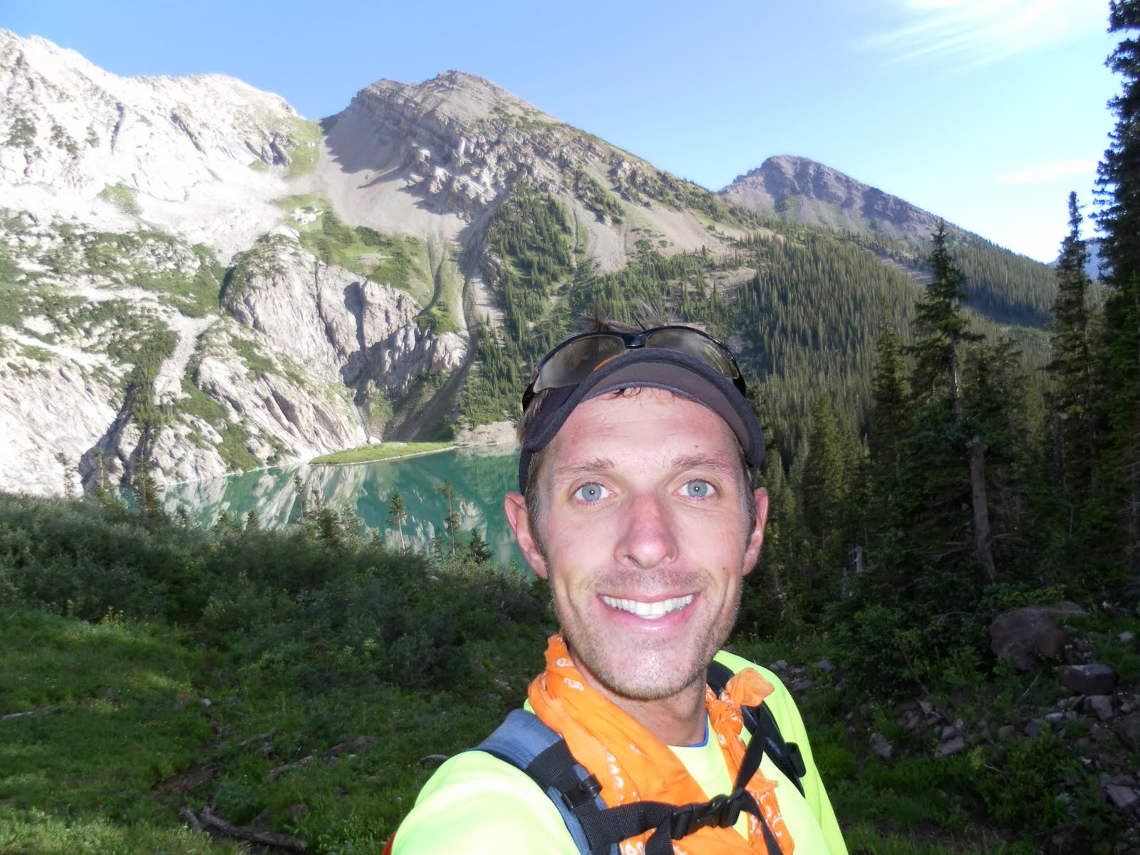
Aspen Maroon Bells Four-Pass Loop
~28 miles, ~9k elevation gain
8 hours CCW (Buckskin, Trailrider, Frigid Air, West Maroon)
The Maroon Bells Four-Pass is a true Colorado/North American/World classic section of trail. It's often done as a 3 or 4-day backpacking loop. Of course, to the trail runner, it's an epic binge of trail and scenery crammed into one day.
I won't repeat all of the details on the route, which are well-documented elsewhere, so this will be about my specific experiences and thoughts.
I arrived Fri night around 10pm, drove up to the upper overnight parking lot to find it full, so headed back down a quarter mile to the West Maroon portal parking lot. Now, there's been very recent talk on 14ers.com of porcupines in the area that have been munching on car wires at night, so folks have either put up chicken wire around their vehicle, sprayed some sort of repellent, or risked having to drive back down Maroon Creek, Independence Pass, etc. with no brakes(!), if their car even started.
I had some chicken wire and "Critter Ridder" with me. I got impatient with the chicken wire, as it was all knotted and twisted up in a bundle that seemed like it would take 20 minutes to unravel, so I just sprayed Critter Ridder all under the car. The car wasn't bothered all night, though neither were any of the neighboring cars, as far as I could tell.
I woke up and relocated to the day parking lot. Got everything set, and headed out just before 6. It was definitely light enough to see, and though I had been up for over an hour, I should have started half an hour earlier. Oh, the forecast was 30% chance of storms, mostly afternoon -- which seemed like typical monsoon season weather -- but 50% chance in the Elk Range mountains. This could have gone either way and I debated making the drive, but glad I did, as they day dawned with just a few high clouds.
So at 5:52AM, headed up with the Bells in alpenglow:

I decided to do the loop counter-clockwise. TA Justin Mock did it this way recently, so I was better able to use that beta, and another climbing report mentioned this direction to get the steeper Buckskin Pass 'out of the way' earlier. More thoughts on this later. He also warned about avoiding the "Upper Scenic Loop" section which gets you off the main trail, so I was most careful with these directions.
I had been enjoyed a couple of pleasant fall hikes on the Crater Lake trail, so the familiarity was comforting. After the couple mile warmup, I entered new territory heading up to Buckskin Pass. Trees gave way to wildflowers and views:


The trail climbed through the trees, before popping out, where I saw a couple of guys in military camo taking a break with full packs, taking some photos. They said their packs were over 40lbs. We both respected each other for the way we were doing it!
Other than a few earlier gear adjustments/photo ops/map checks on flat spots, my goal was to run steady up at least the first pass. This was actually easier once the goal/finish line was in view.

I topped out here at about 1:25.
To my surprise, right before the top, I heard voices and saw runners on top of the mountain.

"Hi, runner!" called one of them, as the others were heading down. I asked where they were headed, and they said "Trailrider Pass" -- the next pass in the loop -- and pointed in the direction. "Me, too, but after a quick break, maybe I'll see you soon" They bounded down the hill in conversation as I grabbed some food and took in the views, proud of the first section now completed, and humbled by the next giant basin in front of me.
Now I took off down the hill, staying relaxed and sure-footed more than bombing it down. The tightness in my calves from climbing released instantly, and it was nice to flow down the hill. At the bottom, I ran into some of the first real hiker traffic of the day. After winding past them, I'd catch a brief glimpse of the forest nymphs ahead before losing them again, so it was a primal chase to catch up.
Eventually I did, and I began talking with the 3rd runner, who said I could pass any time. I wasn't in any hurry, I enjoyed the company knowing that it would be a long day. She introduced herself as Lauren Arnold, and said they were out for an out-and-back to Trail Rider, mostly due to time and that she was recovering from injury (though I can't imagine how strong she would be running uninjured!) That name sounded familiar but I couldn't place it -- in fact, I have a cousin-in-law with that last name, so having seen it in print before, it stuck inmy head. I tried to recall where I might have seen that name. Lauren demurred and mentioned that likely it was her sister, Ashley, who writes for Trail Runner magazine. Maybe that was it...
We talked about racing a bit, she's still recovering from a hard road marathon in Cincinnati. "Flying Pig?" I asked. "Yes!" I had heard of it/read about it before, apparently the she's just starting to recover from a tough effort there. But more on that later...
I did pass on a rockier section, and said hello to the other two. They waved me on again as they stopped briefly to regroup, though again I said I was in no particular hurry. Soon enough, though, they were right behind me, and we had a chance to chat. "Unless you're trying to get away from us!" By no means! This was Ashley Arnold and Elinor. Between them, they were one week recovered from the Silver Rush 50; one week out from White River 50; and getting ready for the Leadville 100. Heckuva recovery/training run for all that! We 3 had all done the CP50 earlier in the year, as it turns out.
I was enjoying both the conversation, and cruising on the trails, and it turns out we were picking up the pace from each other, which strung out their group a little bit. Eventually we reached the trail crossing for Snowmass Lake and stopped for a map check, chatting some more, as they regrouped and decided as a group to head down to the lake instead of the pass, which they were all OK with. "Hey, we're out here on an awesome run in the mountains!" one of them said. Couldn't agree more.
They gave me great advice and guidance on the rest of the loop, including being careful not to drop into Lead King Basin later, so I bid them farewell and headed up toward Trail Rider.
Now here's the amazing part of all this: one reason, perhaps, I remembered the name was that Ashley was the winning female in Collegiate Peaks this year. By being ahead, not only did she "chick" me (and I use this term in a lighthearted, if not empowering sense), but absolutely crushed me by almost 45 minutes! Wow! And Elinor wasn't too far behind me in a solid race as well...Elinor Fish, as it turns out, the editor of Trail Runner magazine. As for Lauren Arnold -- she won Flying Pig, in ~2:55! Small details, all of which I learned out of google curiosity.
Anyway, I truly enjoyed meeting and chatting with these very talented runners, and enjoying part of their local trails. I am continually impressed by humility and friendliness of the trail running community, and wish them the best in their upcoming races.
Back up the hill, and gorgeous Snowmass Lake came into view:

After taking in the views, I began chugging up Trail Rider, where I encountered a few friendly hikers and a refreshing patch of snow:

With the top in view, I slowly jogged and power-hiked my way up. Another short break, and I believe I started heading down around 3:09.
This drop was a bit more runnable, which was nice, but I needed to fill up the bottles. For this, I've been using a Steripen Adventurer. Knock on wood, I haven't gotten sick yet (used it last summer also).

Now I was dropped into Fravert Basin. Still coming down part was nice and runnable. I saw a few hikers coming up, which either said "Good job!" or asked how far/where I came from. Tried not to be a slut for praise, but it felt good, a nice stoke with some cheering out their in the backcountry.
Also played around with some video here.

After the drop was a long low section in the basin. I knew it would be a slog, as I had warning about downed trees by the river as well. I saw a couple trees on the side of the trail, and right at the 4-hour mark, I saw a couple runners coming at me, for the first time all day, doing the loop clockwise. One of them was Steven ??? from Boulder, I asked them about the downed trees. They said they weren't too bad, about a mile ahead, and that their was a bog and water and I'd get my feet wet. Also, he figured we were at the halfway point. "First one back buys beer!" he shouted as they left (Wait a minute....)
I saw 1 or 2 more running parties, and then got near the river. Sure enough, downed trees everywhere, as if a monster from "The Neverending Story" had his way. I kept an eye on the trail but dropped to the river shore. This didn't always help, though, as it was muddy, swampy, and some of the trees reached the shore. I waded through muck and then the river itself, getting nearly waist-deep. Finally, the trees broke up enough that I bushwhacked up from shore, and was happy to find the trail again.
I headed further into the basin -- it was thick and lush with growth and wildflowers. But, I couldn't see an obvious pass or weakness anywhere in the basin around me, and I hadn't seen hikers for awhile. I got paranoid that I missed the trail and was in the wrong area, so I did a paranoid map check. Seemed right...I kept going, and recognized a waterfall from various pictures. Good sign. Kept going through more jungle-like foliage, started getting hot and tired. Kept slogging along and eventually the Frigid Air pass came into view, again switchbacking up a rock wall. I hiked that whole thing, no running, and was glad to get on top.
Saw a couple guys there and took a quick snack break. I was well over 5 hours now, maybe 5.5? The low point was over, though, as the last pass had less drop and climbing, then the downhill homestretch.
Again felt refreshed by a downhill, and headed down as quick as my legs would let, but not pushing by any means. Ran into a larger backpacking group on the trail. "Howdy!" I called, one of them said "Hi" back. "Howdy" I called again, before two of the guys got the clue and actually stepped off the trail. They joked and said, "Crazy trailrunning bastard!" as I went through.
I passed an older guy who had no pack and looked like he was in great shape, but then I needed to make some water. He caught up in a running shuffle, and we chatted. He used to run this area in the 80's(!) and mentioned some different options/basins they connected -- and that the route was much less well-defined then. He took off, and after getting my water ready, I passed him again. Feeling good going slightly downhill, then all of the sudden my right leg cramped and seized right up, right along the inner thigh/hamstring. I slowed to a shuffle as my left leg cramped up as well. Wow, and ouch! Never had something happen that quickly from running (has happened after long ride). I did have some electrolyte pill samples, (most of my non-food food was goody bag samples I stuffed in my pack), took those and hiked, and the combination of quick rest/massage and that helped me keep going. Able to keep going the rest of the way without issue.
Saw my final pass, West Maroon, with a bunch of people on top that had done a day hike in the opposite direction. Happy to get up there and peer down. Didn't spend much time on top, good on water, made my way down for the last section.

Now tons of hikers coming up. I would say, "Hello" and most of them got the hint and yielded, which was nice, some of them said "Good job" and I don't know if they thought I was running an out-and-back to one pass or if they knew about the whole thing...that doesn't really matter, what does matter is the occasional non-yielder who doesn't move for some reason and has no idea what you've been through all day. But anyway, most people in this stretch were good. One woman said, with some admiration, "There's one of those runners you were talking about!" I called out, "I've been running since 6AM!" and they groaned in unison..."From that way!" (pointing backward) and they groaned even louder. That felt really good, and I actually had a big runner's high right after that -- the combination of the hard work being done, cruising easily downhill, and interacting with other people out enjoying the day.
Closer to Crater Lake, though, it got tougher with water crossings, more rockiness, repeated terrain, and plenty of gapers on the trail. One party of 3 was stopped right in the middle: a gentleman sitting down in the middle, who did apologize; and two women facing either direction, having a conversation (meaning one of them could see me coming down easily) -- I said "Hello" twice, and eventually "Excuse me" twice, but they were oblivious. This wasn't a case of wanting to run through, I barely had room to walk past. Kind of a bummer, and if you're reading this, I'm mostly preaching to the choir, but
There's never a good reason to stop right in the middle of the trail!
Now lots of parties to contend with, mostly friendly (but less so than the backcountry campers), more cotton and jeans, some of them looked like death from a 1.5 mile mostly flat excursion to the lake. Near the end, one guy called out, "4 Pass loop?" "Yup!" "One day?" "Yup! Thanks man!" Glad somebody was able to share my stoke on that part, as I was almost done.
Pulled in right at the 8 hour marking, total. I was thinking 7-9, so I guess that was in the middle, though yeah, a little faster woulda been nice. Brought too much gear (heavier food, 2 maps, extra shirt, thick rain jacket instead of ultralight one), could pare it down next time. Spent at least 40 mins on water purification, map checks, conversation, pictures, etc. But, since I didn't get caught in any storm, very happy with how the day went.
At the TH, grabbed a cold beer from my cooler. No sign of the Boulder crew yet, never ended up seeing them. Saw a guy with a Dead shirt filling a growler with water, started chatting: they were on their way from NY to California, road-tripping on the way, looking to move to Northern California. We chatted about beer, Colorado, and California -- some of my favorite subjects. I learned he hadn't been to the Fort, so I gave him a cold Skinny Dip as a parting gift.
Very pleased with the day, definitely an awesome trail!
Thursday, July 22, 2010
Rio Bike Night Speaker: Dom Nozzi
Enjoyed a talk at the Rio from Dom Nozzi last night.
Definitely enjoyed what he had to say, and learned some things. In urban planning, of course, due to all the tradeoffs involved, there is much opinion. There is also much data available for comparative purposes on street design. I wrote/remembered some down, I'll have to dig it up, or leave it to the user. Some highlights:
1. Narrower streets reduce traffic accidents and speeds.
2. Wider roads have partially been driven by demand for faster fire/EMS response, especially with larger fire apparati. It has been suggested, and implemented in various cities in the US and Europe, to consider the size of purchased fire trucks so as not to artificially create the spiral of needing/wanting bigger roads. Nozzi's suggestion is also to increase interconnectedness of roads -- ironically, we build big, wide roads, and then end them in dead ends and cul-de-sacs.
Ironically, he also mentioned, in the context of political will, the tough argument of EMS response: the 'burning baby in a building.' The irony is that slightly faster fire response, real or perceived, pales in comparison to the danger of increased traffic accidents.
3. "Attentive" vs. "Forgiving" streets
Nozzi argues, with quoted support and data from other studies and planners, that designing wide, straight streets promotes inattentive driving (the cause of 80% of vehicle accidents). There was a great quote from a Dutch traffic engineer about promoting 'idiotic behavior'
4. "The High Cost of Free Parking" -- it's a whole topic and book upon itself, but it touches on how cities/downtowns enter a vicious cycle of promoting driving/reducing biking and walking because of ample free parking -- which comes at an economic, enviromental, and quality-of-living-cost

5. Biking/walking is best promoted by a "herd" and familiarity. Nozzi had a prioritized list of what he thought would best promote transportation. He had interesting arguments about putting bike lanes low on the list, because if roads were designed appropriately for safe, mixed used (lower speeds in dense areas, better lines of sight, etc.), and people are out there cycling/walking, drivers will be more attentive to them. Another aspect of familiarity is having more 'normal', everyday people out there riding: women, businessmen, etc. He even suggested that pushing helmet laws too hard results in a 'dangerization' of biking, so that the bulk of riders end up being lycra-clad speedsters rather than everyday folk.
I like this argument, and I'll take it a step further...one member of the audience asked about the problem of drivers receiving a 'slap on the wrist' for killing a vulnerable, law-abiding cyclist/pedestrian, and that inattentive driving resulting in death has nowhere near the stigma of a drunken driver killing someone else (which still is too acceptable, IMHO, but groups like MADD certainly have made a stastical dent in that problem). Nozzi understandably didn't have a solution to this legal conundrum.
My belief is that the more people that are out there cycling and walking, not only will drivers be more familiar, but they will be more likely to empathize with fellow human beings.; that is, more likely to be upset at accidents because it could be someone they know.
*************
In sum, I enjoyed this talk and learned quite a bit. Why should everyday folks listen to stuff like this? Because we're a society that actively designs and pays for these things. I couldn't help but think of much of this in basic economic terms. Rather than accept big wide roads and free parking, let's think about what we lose. We spend quite a bit of public space just on pavement. This means less land available for homes, businesses, and recreation....and, as the data are showing, increased speeds and more accidents! Economically, we externalize these resource, environmental, and safety costs on others, while actually promoting even more speeding, lazy, and inattentive driving. We're actively enabling ridiculous behavior and ridiculous vehicles by accomodating it with our tax dollars. That is, for all the whining about paying for bike paths, why not commensurate whining about paying for big roads and parking spaces?
Nozzi claimed anecdotally that planners know all the tricks for traffic calming and increased mixed-use -- they just don't always get 'permission' to use it, so they're forced to stick to outdated defaults. With more education and political will, we can build better cities.
Of course, this is just his (and mostly my) opinion. As usual, I have to keep this in mind that one opinion isn't everyone's. It's also possible people love wide roads and strip malls, hate biking and walking and public spaces and weather, and can't-find-a-darned-parking-space as we speak.
Definitely enjoyed what he had to say, and learned some things. In urban planning, of course, due to all the tradeoffs involved, there is much opinion. There is also much data available for comparative purposes on street design. I wrote/remembered some down, I'll have to dig it up, or leave it to the user. Some highlights:
1. Narrower streets reduce traffic accidents and speeds.
2. Wider roads have partially been driven by demand for faster fire/EMS response, especially with larger fire apparati. It has been suggested, and implemented in various cities in the US and Europe, to consider the size of purchased fire trucks so as not to artificially create the spiral of needing/wanting bigger roads. Nozzi's suggestion is also to increase interconnectedness of roads -- ironically, we build big, wide roads, and then end them in dead ends and cul-de-sacs.
Ironically, he also mentioned, in the context of political will, the tough argument of EMS response: the 'burning baby in a building.' The irony is that slightly faster fire response, real or perceived, pales in comparison to the danger of increased traffic accidents.
3. "Attentive" vs. "Forgiving" streets
Nozzi argues, with quoted support and data from other studies and planners, that designing wide, straight streets promotes inattentive driving (the cause of 80% of vehicle accidents). There was a great quote from a Dutch traffic engineer about promoting 'idiotic behavior'
4. "The High Cost of Free Parking" -- it's a whole topic and book upon itself, but it touches on how cities/downtowns enter a vicious cycle of promoting driving/reducing biking and walking because of ample free parking -- which comes at an economic, enviromental, and quality-of-living-cost
5. Biking/walking is best promoted by a "herd" and familiarity. Nozzi had a prioritized list of what he thought would best promote transportation. He had interesting arguments about putting bike lanes low on the list, because if roads were designed appropriately for safe, mixed used (lower speeds in dense areas, better lines of sight, etc.), and people are out there cycling/walking, drivers will be more attentive to them. Another aspect of familiarity is having more 'normal', everyday people out there riding: women, businessmen, etc.
I like this argument, and I'll take it a step further...one member of the audience asked about the problem of drivers receiving a 'slap on the wrist' for killing a vulnerable, law-abiding cyclist/pedestrian, and that inattentive driving resulting in death has nowhere near the stigma of a drunken driver killing someone else (which still is too acceptable, IMHO, but groups like MADD certainly have made a stastical dent in that problem). Nozzi understandably didn't have a solution to this legal conundrum.
My belief is that the more people that are out there cycling and walking, not only will drivers be more familiar, but they will be more likely to empathize with fellow human beings.; that is, more likely to be upset at accidents because it could be someone they know.
*************
In sum, I enjoyed this talk and learned quite a bit. Why should everyday folks listen to stuff like this? Because we're a society that actively designs and pays for these things. I couldn't help but think of much of this in basic economic terms. Rather than accept big wide roads and free parking, let's think about what we lose. We spend quite a bit of public space just on pavement. This means less land available for homes, businesses, and recreation....and, as the data are showing, increased speeds and more accidents! Economically, we externalize these resource, environmental, and safety costs on others, while actually promoting even more speeding, lazy, and inattentive driving. We're actively enabling ridiculous behavior and ridiculous vehicles by accomodating it with our tax dollars. That is, for all the whining about paying for bike paths, why not commensurate whining about paying for big roads and parking spaces?
Nozzi claimed anecdotally that planners know all the tricks for traffic calming and increased mixed-use -- they just don't always get 'permission' to use it, so they're forced to stick to outdated defaults. With more education and political will, we can build better cities.
Of course, this is just his (and mostly my) opinion. As usual, I have to keep this in mind that one opinion isn't everyone's. It's also possible people love wide roads and strip malls, hate biking and walking and public spaces and weather, and can't-find-a-darned-parking-space as we speak.
Wednesday, July 21, 2010
Rio Bike Nights Speaker Series
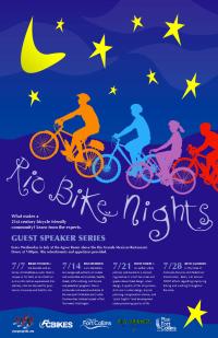
7pm, Rio Grande on Mountain Avenue
Wednesday nights
Hoping to head to this tonight, weather-permitting (stupid lightning is the only time in the city I'd always rather be in a car). Didn't hear about in time to catch previous speakers, but sounds like a good time.
Tonight, Dom Nozzi (www.walkablestreets.com), author of cool sounding books like "Road to Ruin" and "The Car is the Enemy of the City"
Great quote from last week's speaker, Dan Burden:
"Everybody out there knows that everything revolves around the automobile," Burden said. "But what if that's not true? What if we finally discovered that it revolved around the human being and that it always has?
Monday, July 19, 2010
Donner Pass Duathlon
Donner Pass Bike 'n Hike
72 miles bike RT
12 miles hike RT
I first read about the Donner Party in middle school, courtesy of Stephen King's "The Shining," and was captivated by the story: a party of pioneers basically caught in a horrible winter in the Sierras, where some of them ultimately resorted to cannibalism for survival. Mostly, that story conjured up images of deep snow in high mountains, something I had never seen, in a land called California which I had also never seen.
Fast-forward to 2006, when I was fortunate enough to live in California for 4 years, spent some time (but not enough) in the Sierras, before heading to Colorado. First thing to do in my new home? Stare at open spaces on maps. One thing jumped out at me to the West of Fort Collins:
"Donner Pass."
I knew I had to check it out sometime. There's not much beta out there on it -- local mtb blogger Kerkove had a brief mention of it -- and I similarly envisioned going on a mt. bike trek there eventually. But it's in a weird spot -- it holds snow forever in the trees, and by the time it melts out, I'd usually prefer to drive further to get above treeline. (The pass itself is at 10k feet, and surrounded by trees). So I hadn't been there yet.
So today, I couldn't make up my mind on where to go -- was thinking about driving to Cameron Pass -- but slept in until 7, didn't get ready until 8:30, and decided to just go for a duathlon and get some time outside. Depending on how things went, I could go all the way North to Buckhorn, or add a short jaunt up Lookout Mountain, just as long as the whole section took around 4 hours. But, things didn't work out that well!
I made the hot, uneventful bike ride down to Loveland and up the canyon. Nothing too blazing fast, but nice to know I can hop on the bike whenever I want and feel like I can ride as far as I want, without having ridden much in months. (With one exception: my shoes/cleats continue to push on a nerve in my foot, so I need to fix that before doing longer riding). Now, one of my maps shoes dirt coming all the way down to the Devil's Gulch Hwy, but it turns out those are all private roads. Truly, the public south TH requires going up to Dunraven, no shortcuts. That means grinding a road bike up 2.5 miles on a steady dirt grade in the heat, which is a kick right before you start running.
I locked up by bike and got ready to head up Bulwark -- I could have ridden another 0.4 miles or so up to where the actual trail forks off. Now, I tried something else new which didn't work out so well -- I brought my full Go Lite day-pack with 3 bottles of water, a filter and pump, food, and some bike equipment, which weighed over 15 pounds. Previously, I've gone lighter by bringing 2 smaller packs, and leaving one pack with bike gear tied to the bike. That's worked well in the past, and I'll go back to that system. Since I've been feeling good while hiking with the bigger pack, I thought I'd just be able to take the extra weight, but it really slowed me down.
Oh, you might think the water system is overkill, too, but there's no water at the TH, so rather than finish a run/hike with more cold water (or beer) in the car, I need to make sure I have enough to keep on riding. So you gotta bring more than usual.
Anyway, I headed up the short road section, then the trail section toward the Indian Trail. This was a steep but steady grade for the first mile. At the top, by the Signal Mt. junction, I saw a woman waiting for someone, and some forest workers cutting some dead trees. These were the only other people I saw all day -- this is not a popular trail.
I did, however, kick a chipmunk for the first time in my life. Not on purpose, mind you: I was trudging slowly uphill, and a chipmunk freaked out and darted across my path. As I took a step, he ran in front of me and bounced off of the top of my shoe, before scurrying away.
Now, down the Indian Trail -- steep, loose, rocky, rooted, stumpy switchbacks. I couldn't run that fast with my big pack, and was afraid of twisting an ankle in the middle of nowhere, so I took it easy. At the bottom, I reached the junction of the Miller Fork trail and river. I filled up a water bottle and crossed the river in a few tricky spots only to find dead ends, as I assumed the 'real' trail crossed the river while social trails went further down to find easier crossing. As it turns out, the most well-beaten trail is the real one, duh! You don't cross the river immediately, you just go alone it before hitting a log bridge.
Now some more climbing, and occasional meadows and wildflowers. More rocky switchbacks, and one corner with an open view to RMNP. (Sorry kids, you and your fancy graphics, no camera -- when I was your age, I played a few completely text-based computer games with NO graphics on the Commodore 64!) I had a bit of cell coverage here, which wasn't true at the TH, so I gave J an update. Through another meadow, and I heard some sort of grunting noise, but didn't stick around to see who was making it. Now, some more rocky uphill through a steep, wooded hill. I was not making good time, and I was basically hiking the whole way. I was disappointed in not being able to run more, but with the heavy pack and bike ride, I won't chalk it up to too much as long as my other runs go decently. The only good sign is that I feel like I can hike quickly all day with a pack, maybe not a surprise if I've been doing that at least one day most weekends.
Finally, after more than 2 hours, and hopping some deadfall, I reached Donner Pass. (By the way, the mileage marker from here says 6 miles, whereas it was 5 miles, added up, from the other direction). With the late start, understandably, weather was coming in, and I heard my first thunder. This, and the time, ruled out any further options for the day. Took a quick break then headed down the hill.
I was able to jog on the early uphill and flats, but nothing earth-shattering. On the way up, I noticed a rivulet path that cut straight across the switchbacks, so I took that down instead, cut through some trees, and was happy that it all worked out when I hit the trail again. This section reminded me of what I've read about the Barkley -- basically, you're humping up and and down forested hills without much feedback on progress. Hardrock seems much more satisfying to me since you can see where you're going and where you've been -- the mindset of rolling through hills that look the same seems like a tough mental challenge in itself!
Filled the bottles again and explored a small mine/cave by the Miller Fork, before the final grunt back up the dreaded Indian Trail. Finally popped out after 4 hours of hiking, water-filtering, exploring, and other monkey business.
Saw a guy (Brett) and woman when I popped out, luckily I was running in good form. He asked where I went, and said, "Let me guess, that's your bike down there, too?" He was impressed by the roundtrip which made me feel good, and asked if I had done Round/Sheep, and told him I did that one as a Duathlon, too, but should like to return for a proper TT some day. Anyway, nice seeing them, and more clouds rolled in.
At the bike -- flat rear! First duathlon where I had a flat from parking. Otherwise bike, helmet, and shoes were undisturbed. Put in a new tube and coasted slowly down Dunraven Glade Rd -- last time, I nearly wiped out going >30mph in the last corner when it changed from hardpack to looser gravel. Also kept feeling my rims for overheating and checking the pads. Finally back to pavement, able to coast home. Chased by a storm, but it was mostly swirling to the north.
With food stops and everything, I was out there around 10 hours. Disappointed in the run distance, as last year I did over 20 miles from the same TH up to Stormy Peaks, on the North Fork trail, which was much more runnable. However, I do feel better mentally for a 100. The duathlons are nice because you break things into thirds, or even quarters if you consider the out-and-back of the run. At no point do I think about how much time is left, just about where I'm going. If I'm tired, usually I can drink/eat more and feel better quickly. Once I hit the bike, I think I'm home free/easy sailing, even though I've got ~2.5-3 hours to go. I need to keep that mindset in a hundred -- get the first 2/3rds done, and trust that my legs will bring me back.
But, this isn't supposed to be a pure training blog so much as it is trail beta...
Several sections of this route were tougher than I needed for pure distance, 18-20% grades according to mapmyrun.com.
How about mt. biking? After the initial 2 miles from the South, some of the singletrack was sweet enough, and the technical sections were manageable enough, that it would be a fun ride. I would investigate out and backs or loops from the North, as hike-a-bikes in the south section would kill your flow. You could probably build some sweet illegal trails and obstacles in the hill below the pass -- I'm not into that sort of thing, but it just looked like a place where somebody would so somethign like that.
Lastly, my overall ride there and back was utterly uneventful. No close calls or harrassment from other drivers, people are doing really well with the 3-foot passing rule. Nearly unprecedented. Amazing!
"Old Baldy" Pt. 13038 IPW

"Old Baldy" Pt. 13038
Indian Peaks Wilderness
~7.75 miles RT, ~4.5 hours
With predicted high temps in the 100s, there was no doubt on where to go: above treeline. However, we also an appointment in Denver mid-afternoon. Working backward from that, visiting Indian Peaks wilderness seemed like a good choice. Then, I decided to check out the 4th of July TH, since we've never been there and it's free; and the plan was to hike the Arapahoe Glacier trail to the saddle between "Old Baldy" and S. Arapahoe, then picking a mountain based on time and desire.
We left Fort Collins at 5am on Saturday, and got to the TH at 6:45. Some cars there already, but it's a campground, and wasn't too bad. We ran into 3 people in the first half mile, we passed 2 of them and the solo guy passed us; after that, we had the trail to ourselves.
Wildflowers of all colours were on display:

We passed alternated between dense forest canopy, stream and waterfall crossings, thick wildflowers, and amazing views.

A tall waterfall roared in the distance. At 2 miles, we hit the Arapahoe Pass junction, and the old 4th of July mine, which was a buried pit and some old equipment.
We took the right turn to switchback up toward the saddle. The trail was nice and well-maintained. Finally, at the saddle, we were able to peer down at Arapahoe Glacier, as well as getting great views of the Arapahoe traverse. S. Arapahoe by itself looked like ~45 minutes of steady scrambling (shown behind me in this picture), truly a legitimate and worthy mountain, but we did the gentle x-country walkup to "Old Baldy" instead.

And while we saw a few folks heading up S. Arapahoe, we had "Old Baldy" to ourselves. We laid down in the sunshine for a 20 minute nap or so, though I'd sit up every few minutes and look around at the amazing views.
Time to head down, where we saw ~40-50 people coming up, along the lines of what I expected in a popular area.
Now, back at the car just before noon, we reached the crux of the route: navigating through a cluster of traffic. I wiggled my way out of the parking lot while some guy waited for my spot, waited a couple minutes for a cop and another guy to finish a conversation through their car windows, then headed down the road clogged with park cars to the Hessie TH. There, traffic was backed up, while an old woman "took charge" by demanding everyone back up the hill so she could get through. To make it worse, one of the SUVs was driven by a tentative young woman who couldn't back up her car to save her life. (Literally -- these are the folks that swing a sickle six inches from my shoulder unaware when I'm on my bike. Oy.)
To the rescue? Scott and Anton! No, literally, these guys helped direct the girl's car so she could back up. I saw them on the way past, and when I was waiting, said "Hello" -- both were incredibly personable and friendly, and were equally perplexed about all the traffic in the mountains. (Coincidentally, someone on 14ers.com posted a comment on the traffic/parking on that day as well, so something unusual must have been up?) It was nice meeting them briefly, sounds like they had a nice run as well.
Generally a great, moderate hike, with awesome views, wildflowers, waterfalls, mountains, and glaciers. I can see a future trip involving the Arapahoe Traverse, as well as popping over Arapahoe Pass.
Thursday, July 15, 2010
24-25 July Weekend Plans
J is out of town 24-25 of July weekend, looking for some weekend miles and elevation.
Sounds like Nick is heading up Longs -- but I think I'll hold off on that for a few weeks, and head up there with J.
I was thinking about making camp somewhere around Aspen, Leadville, or Glenwood for the weekend, and doing something both days. Maybe longer/more technically challenging on Saturday, and then more conservative technically on Sunday?
Options:
* 4-pass loop from Maroon Bells TH
* Rio Grande trail: 41 mile rec path Glenwood to Aspen, take the bus back (goal here is to get more miles at elevation)
or (pick 2 of 3)
* Some sort of multi-summit Sawatch binge (class 2/3)
* Tenmile traverse (class 3)
* Some sort of Hoosier Ridge stuff -- 'easier', might be runnable ridge at elevation?
* Other CO trail stuff with decent miles
or
* Sit at home and drink beer
-----------
Anybody interested in any of the above? I'd probably not do anything long class 3+ solo, so would appreciate any strong and motivated company on those. If I'm solo, I'd probably do the more conservative rec path stuff, maybe ride Independence Pass instead. Probably evaluate on weather and stuff. Looking to do something both days...or anybody else got any other big plans?
Tuesday, July 13, 2010
Silverton 4th

With the 3-day weekend, J and I headed out West. With 99,500+ miles on the Soobie, we wondered where we'd end up when we hit the magic number...
Silverton was our destination for the 4th, and was an awesome place to make camp for a couple days. We've driven past before, but never had a chance to check it out properly. We love Leadville already, but we like Silverton even more. It's somewhat less touristy, more laid-back, weird, rough, and extreme. Most of the roads in town are wide dirt roads.
Camping
I sold J on the fact that there was a rhubarb festival on Sunday, in addition to a 5k/10k race, fireworks, and parade. With solid hiking days on Saturday and Monday, Sunday was a laid-back day to enjoy the town. Even better, while looking for camping, I learned that Kendall Mountain is open that weekend for public camping. Yes, it costs money, which usually bugs me about camping -- $10pp/night -- but this spot had the advantage of letting us park the car, walk to town at will, and see the fireworks from our campsite. Well worth it!
We were told to avoid "The Depot" when looking for a more secluded campsite, so once we paid our fees, we headed up a dirt road to the left. There, we found a great pull-in spot with a view of the mountain. We had some friendly but quiet neighbors, but no other tents were visible.
Firebox
Also, per NFS rules, we needed a fire container for our fire. I had a ghetto solution for this in the desert on Memorial Day -- using the lid from a portable grill -- but I wanted something better. It is hard to find an off-the-shelf solution, as it turns out. I was unable to obtain a garbage can lid, but instead found a $15 steel box at Lowe's, a garage storage box. I was leery of how it would work without much ventilation, but it does have some gaps on the side, and convenient handles. (You can tell I'm excited about this, I need to dig up a picture).
Verdict: Awesome. The steel all-around reflected so much heat that I was worried it was getting too hot, but it held up beautifully. The rest of the year, it can sit in the garage with firewood or camping junk in it.
Anyway, after the race, we had an hour or so before the parade began. Courtesy of the race, I won breakfast for two at The Bent Elbow:

The Bent, like most places in town, was offering a breakfast buffet. Good stuff, with pancakes, eggs, hash browns, cinammon buns, and fruit. I got things started early with a good Bloody Mary as well. Friendly folk there, check 'em out!
Next was the parade, which had all the classic elements of music, local groups and floats, candy, fire trucks and military apparati, and local politicians.


The parade ended with a "water fight": first, the fire trucks sprayed water into the crowd, followed by a full-blast battle between the Silverton and Durango fire departments.

Next, it was back to Memorial Park, for the rhubarb festival, which had all possible configurations of pie with rhubarb as one ingredient.

We had a slice of strawberry/rhubarb, blueberry/peach/rhubarb, and a rhubarb cobbler. And ice cream. Mmmm!
The rest of the day, we checked out the Montaya Rum Distillery. It was always busy when we went past, so I didn't get a chance to learn more about the rum itself nor try it straight, but the mixed drinks were awesome!

We also hit up the Silverton Brewery a couple of times.

The Brewery/brewpub doesn't have much selection for food, so we didn't eat there (unless you count Red White and Blue Jello shots), and the staff seemed somewhat disorganized, that at times you wondered how they pulled it all together. Understand, though, this is meant as a compliment, and seems to fit in with Silverton -- nobody was in a hurry, and it was about the beer and good times, not profits and competition.
So the staff and locals were friendly and laid-back, and the beer was awesome! I particularly enjoyed the Red Mountain Ale, one of my favourite beers of all time, and the Bear Ass Brown, a solid drinkable summer brown ale. I got cans of these (and they are quite tasty in the can) for camping.
After all that fun, we headed back to camp for a siesta.

Remember, the plan was to park the car all day and hang out at camp, but that was thwarted in the middle of the afternoon, when one of our neighbors, from Durango, asked for a jumpstart on his truck, as the battery had died. Did I mention we camped with 99999 on the odometer? So we drove 40 yards or so down the road, and got him going. I showed him the odometer -- thanks, Soobie! (Yes, that means we crossed 100k on the way out the next morning. We owed it to the car to be in a cool place when it happened).
At night, we sat back and enjoyed the fireworks, as the echoed off the canyon walls. Camping there for the weekend ended up being a blast, hopefully we'll do it again some other year!
On the way out, we stopped in Ouray, which was also a cool town, our in-laws really enjoyed it there. A little bit touristy, but a gorgeous location and not as tacky as Estes Park. They have a cool independent bookstore, wish I had gone there earlier, as I forgot reading material. They had shelves/sections for local writing; trails (including smaller self-published books); nature/outdoor and Western writing; Ed Abbey, Kurt Vonnegut, and Ayn Rand (for balance?); and an intriguing section called "Mormon Interest," which included the likes of "Under the Banner of Heaven," Mountain Meadow Massacre histories, and a few female autobiographical FLDS accounts. We also enjoyed lunch outside at O'Brien's pub, which had great fish and chips, chicken pesto sandwich, London Pride on tap, and a view of climbers on the rock wall above town; and we got some good fudge and coffee from a confectionary (bringing your own mug lets you roll a die for a 'random discount'). Good times!
Monday, July 12, 2010
Housetooth

Photo used without permission from Justin Calvert
Horsetooth Rock
~38 miles roundtrip
Some climbing
My wife and I happily bought our first condo 3 years ago with a great view facing West. We've enjoyed watching literally hundreds of sunsets from our patio, often while eating dinner outside, exceeded only by our enjoyment of watching electrical storms roll through. I've been able to appreciate how the sun sets in various different notches in the foothills at various times of year, and how the ambient light at sunset has a strikingly different spectrum of colour to it in the summer versus the harsh flatness of the winter. We have dozens of pictures of unique sunsets -- I shall retrieve one later and put it in this post.
Staring off the patio or out the kitchen window, certain peaks catch my interest. In the far corner of the window on a clear day, Longs Peak lords above everything. Naturally, I wanted to head out my door to climb out, and was happy to do so last September. Closer in is Horsetooth Rock, which dominates the Fort Collins foothills skyline, and is one of the most popular hikes for locals and visitors alike. The Rock is a re-assuring landmark to the West, visible from anywhere in town, a beacon that calls us up higher, where we can look further West to the big mountains, and look down East on our happy town, and look even further East and be glad we don't live there.
I've duathlon'ed Horsetooth before, as well as skied (I used that term loosely, as there's always lots of rocks to pick around) most of the way up and down, but I've never run right from my house. While I'm a bicycle apologist and quite happy to use mechanical advantage, there's something even more primal about heading up something tall, from your own home, with your own two feet. Now, Nick and Tony regularly head up their respective mountains from their front doors on the edge of the foothills, but I need to pick my way through a couple hours of suburbia to get there and back, similar to Brandon's run up Green from his house.
So I had this one on the list for a day where I didn't feel like driving or biking anywhere.
Anyway, headed out the door at 6AM. Still need to get a small camera to make some of these reports more interesting. Nothing really notable about this run, except for I carried 2 bottles instead of one, and I brought a host of assorted packaged endurance pseudo-pharmaceutical faux food. A note about this: J was cleaning the cupboard and asked about getting rid of various packs of gels and shot-blocks and other trademarked things taking up space, random objets d'calorie that I've received as a gift or in race goodie bags, so I brought all this junk instead of my usual heavier and labor-intensive PB&J sandwiches, etc.
I think the shortest, most direct route ends up around 32 miles round-trip, but I wanted more trail, some scenery, and a loop, so I headed to Coyote Ridge first. Up the ridge, down into the valley, enjoying the cool shade of the morning, and white, purple, and yellow wildflowers popping up everywhere. None of this run was particularly new, until I got to the new Blue Sky Trailhead: "They paved paradise/and put up a parking lot." There, I had a convenient place to fill my bottles and get a drink, even though Soderberg wasn't much further. I headed through the campground, buzzing with morning activities and the smell of camp breakfast wafting in the air, before reaching the Soderberg TH.
Now, on the up-and-up, up Towers consistently but in no particular hurry, where I saw a few folks enjoying the day, before peeling off onto Herrington, to Spring Creek, and Wathan. At the last bit of the HT trail to the top, a couple of ladies were resting with their dog. I headed past, and had the top to myself -- here I was worried that it would be crowded on a weekend! I scanned around in both directions, wondering what's out yonder in those mountains, and what everyone was doing below on a gorgeous Sunday morning -- worshipping man-made gods in man-made houses? Listening to the same stories about wandering the desert and preaching on mountain tops? All the while, us heathens are doomed, our butts not on a bench.
Ah, I think too much, this is not good, time to head back down. Wathan to Westridge to Towers. Debated staying high and going through Lory, which is what I guess the cool kids do, but got worried about water, so I called it a day, climbing-wise, and headed back down. More water at the TH, campers packing up from the weekend, lots of boats on trailers heading up. Took the pavement around the reservoir, so I could head to JJ's. I enjoy looking at the reservoir, sure; drinking it's water, yes; but also try to imagine how the canyons looked before The Flood. And, how much more quickly I'd be able to get up there without having to go around!
Back down to JJ's for an blue Icee. I'll rant against HFCS all week, then hypocritically suck it down as frozen slush on the weekend, but don't tell anyone. Also don't tell anyone that I rarely get charged when I fill my mug, let alone full price, but I do try to remember to patronize them for gasoline on that side of town. I don't know if this is for everyone, or just Sweaty People That Look Like Death, but historically I've ended up with free fountain drinks in numerous locales, and I'm not complaining.
Icee made me feel better, though I felt pretty decent the whole run. Had some general fatigue at points right before I ate, but I have to remind myself that eating/drinking, possibly a short rest, and just keeping on the move and it will pass. Ended up being around 38 miles, had to add up numbers on the HT map and I've already mapped out other sections. Feeling good overall, and happy to climb a hunk of rock from my door and be back home for lunch.
Thursday, July 8, 2010
How long does it take for a broken coccyx to heal?
How long does it take for a broken tailbone to heal?
6 months.
I am certain I broke my coccyx while sandboarding last October. I didn't get it checked out, but I had all the classic signs. For 2 straight weeks, it hurt like hell getting up out of a chair. I would 'string my errands' together to minimize the number of times I got up to do something. Sitting down didn't really hurt, just getting up or shifting position.
After that, I just had constant reminders when getting up, shifting positions, or sitting in the exact wrong position. This got better over time, but for no less than six months, I could feel a dull pain occasionally during the day, and every once in awhile it would catch me off-guard and I would wince.
I read people's similar injuries being painful for months, years, or even lifetimes.
Happily, after April, though, it went away completely. Also, it didn't really affect running or anything else much. Slight soreness when bike riding, but tolerable. Never knew if running or bike riding would make it worse, or if it would affect my stride and lead to other injuries, but it didn't. I know I ran some that week, and I'm sure I hiked the next day.
So there you have it, just putting that out there for future Google-ability. Broken coccyx? Don't despair, keep doing stuff as long as it doesn't make it hurt worse.
Wednesday, July 7, 2010
Ice Lake Basin

Upper and Lower Ice Lake Basin Hike
~7 miles
~2200 ft elevation gain
~4.5 hours hiking
Ice Lakes Basin is a popular hike off of Mineral Creek Rd. just north of Silverton, and with good reason: for an easy to moderate effort, one can be surrounded by absolutely sublime beauty.
A couple miles north of Silverton, take the Mineral Creek Rd. (towards the campground) for about 5 miles. This dirt road is passable for passenger cars. Being the 4th of July, we saw plenty of other people camping along the road or near the river, so roadside car camping or short backpacking can lead to good campsites.
After about 5 miles, park on the right, at the TH. The trail climbs steadily and switchbacks through the trees. As you hear a rush of water approaching, you will be below a sizeable waterfall. A social trail leads straight up, but the main trail crosses the stream, switchbacks on the left side, and ultimately pops out at the top of the waterfall.

Now your hike weaves in and out of the forest, and you begin to have views of the surrounding mountains and any wildflowers. Here, at the beginning of July, wildflowers were just starting to show themselves, but it was a mere preview of what the end of July would look like.

Soon, the views open up to lower Ice Lake Basin itself. The lake here is clouded with life, and reflects dark green, but the real story is the basin itself: wildflowers, streams, mountains in every direction, and weeping walls of rock. Stand here, spin around, and pretend you're in any movie that's panning the most beautiful landscape you've ever seen, or just sit and contemplate your good fortune. If you're tired, you could end your hike in this gorgeous area, and it would be a nice place for a picnic.
If you choose to go to the upper basin, it's only around a mile further. Making your way through the basin, there are some short shoe-wetting rivulets to hope across.

As you climb above the lower basin, you get another vantage point of the land you just crossed.

At the far edge, you'll see a trail heading up to the left. The trail does steepen a bit here, I believe it's another 600-700 feet of climbing. A couple ridges tease you before you finally crest the top. The upper basin is spectacular, and has a different feel than the lower basin: rather than the verdant, vibrant hues of plant life below, this basin celebrates rock and mineral, and this lake is sparkling, clear, and blue. Be careful of the steep dropoffs from shore.

We spent a memorable morning here, but saw more than a few backpackers who spent the evening in the lower basin. Lucky! This is truly a magical place.
Handies Peak: Grizzly Gulch Up, American Basin Down

Handies Peak
Grizzly Gulch Up, American Basin Down
~11 miles, 3650 elevation gain (4.5 miles is dirt road connector, see map)
7 hours
Grizzly Gulch Basin and American Basin are two of the prettiest places in the state, with a gorgeous but laid back mountain, Handies Peak, separating them. While the easy way is to drive a car up to the American Basin TH, the most scenery-packed way is to hike up Grizzly Gulch, and down American Basin. I would also suggest going in this exact direction, for several reasons.
First, the view of Handies from Grizzly Gulch is more splendid.

That is, the East Face presents itself as more impressive, while the western route sneaks through a blocked view that doesn't properly present a 14000 foot mountain.
Also, the route along the East Face takes a nifty direction onto a grassy bench before the summit ridge, before rising up along talus to the ridge itself. This exploitation of the surrounding area is better appreciated when going up, and the only touch of Class 2 on this route -- the summit ridge -- is certainly easier when going up.
Finally, this clockwise direction puts the Cinammon Pass road section at the end of your journey, where you're sufficiently protected below treeline and with some vehicle traffic in case of a weather emergency.
In sum, I hope I have sold this route as a fun loop alternative to the more common standard peakbagging route from the American Basin TH, which involves more driving, misses the beauty of the Grizzly Gulch side, and doesn't even yield a minimally satisfying 3000 feet of climbing.
Anyway, J and I found easy, free camping on a Friday night at the Grizzly Gulch TH, just past the restroom and old cabin, complete with a firepit. We got to this TH just fine with our trusty stock 4-cylinder Outback. There were a fair number of other tents, but it was sufficiently quiet, and we slept well.
I should mention, in the way up, we stopped at a Starbucks for the first time in months, and they had coupons for their new-ish instant coffee. I forgot to pack coffee, so this was a fortuitous development for my caffeine addiction. I got up early and made some coffee and oatmeal. Hungrily, I ate a couple packs of oatmeal, and half of Jess's, who didn't have as much of an appetite (poor girl). As you might imagine, this came back to haunt me...
6AM, we headed up the trail, with gorgeous views of Redcloud behind us.

This being the first week of July, we enjoyed some early blooming of wildflowers and general verdancy, though not yet near the wildflower peak.


We kept our eye out for some weather disturbances brought all the way out from remnants of hurricane Alex. Clouds formed and moved swiftly over the Peak, but nothing got pushed high enough to become threatening. We followed the clear and obvious trail above treeline, into the basin, before hooking right/North around a rise before heading up. BTW, Roach refers to going "off trail" at this point, suggesting the trail dead-ends at a lake, but at this time, the most obvious trail is the trail to the summit.
We encountered maybe 3-4 parties total on the way up, either taking a break or visible (or audible) in front of us.
Then, the summit was achieved:

With a belated nod to Canada Day (July 1), I slaked my thirst as a veritable Bizarro Brownie:

After lingering on the summit for a half hour or so, with a rotation of up to 6 others, we headed down to enjoy American Basin and the lakes below.

This trail was well-maintained, easily runnable, but more crowded. I enjoyed running down sections while waiting for J. However, my stomach was beginning to hurt, badly, enough that I removed my camera from my neck so it didn't press against my stomach. I needed a bathroom, and secretly hoped there was one at the American Basin TH. But I still enjoyed the scenery, of budding wildflowers, sheer rock walls, waterfalls, and streams.


Finally, we made it to the TH, but no bathroom, so I ventured into the woods, and returned a new man, feeling much better! I was able to enjoy the rest of the hike. We had a few drops but no threat of storms. Many 4-wheelers and various motorized folks went by, obviously having rented something from some local "adventure" company, but I couldn't help but think about what they were missing.
Anyway, made our way back to camp, enjoying a nice loop hike. Definitely a recommended route in a beautiful area! The only regret was staring at the gorgeous Redcloud Peak for an hour or so as we walked down the road...such a beautiful area, where we'll definitely be back!
Quick Thoughts on Hardrock Course
I know a few folks are headed out to Hardrock this week -- good luck Brownie and NMP with Nick Clark pacing! Wow, what an awesome course. So my wife and I hiked the Handies section of the course, as well as part of Ice Lakes Basin, purely out of interest in doing beautiful hikes, but we couldn't help seeing the Hardrock 100 flags stuck in the ground. Had I thought ahead, I could have stashed a PBR up there! I hadn't thought specifically about doing the race, but after hanging out in Silverton, that course is really growing on me. That, and maybe a dozen or so folks asking, "Are you doing Hardrock next week?" as we talked about running or asked about hiking information.
You guys are lucky, here's to good weather, and have fun!
Some general observations:
Handies Section
1. Top of Handies is snow-free. There is a cornice on the American Basin side, but it is "off-the-trail"/completely avoidable.
2. The only snow at all on the Handies section is on the A-Basin side, where there are very short patches (4-5 steps) not even worth thinking about.
3. CC would seem slightly better for running Handies, but off of the main ridge, the whole thing is runnable.
4. Going up A-Basin, you don't really see the Handies summit for awhile. Just keep going up!
5. Going from the summit block along the summit ridge, there are a variety of social trails through talus. Dropping lower towards the Grizzly Gulch Basin gets you out of the wind quicker -- it all goes the same place.
6. Going off the summit ridge-- besides an incredible view -- you have a slightly steep scree section. I'd go easy here -if- you wanted to stay on the trail, just a few minutes. There are marked flags that show switchbacks through the scree, and social trails/footprints that go straight down. You could bomb straight down the scree if you were careful, the "trail" itself is also loose and somewhat arbitrary. It's dry and loose, fairly consistent (no big rocks, hidden snow, ice, etc.)
7. Tons of water on both sides of Handies, esp. the Grizzly Gulch side.
8. Wildflowers are starting to pop, not peak yet but still should be amazing
9. Trail is well-marked all the way up A-Basin and down Grizzly Gulch once you're off the summit. Nice and runnable. Go for it! Just be sure to turn around and look at Handies once in awhile -- this view is more impressive.
Ice Lakes Section
We hiked up the Ice Lakes trail to the lower and upper basin. I heard that the trail skirted through the lower basin, and sure enough, we saw some flags on the trail. Wow, this course really hits some amazingly beautiful places!
However, I was personally a little confused where Hardrock Trail went. Since I was looking for the trail going "backwards" (down from the basin), I surely might have missed it, but just wanted to let you know, be careful here.
Looking at the course description: Mile 13.0 is obvious. I saw where the singletrack trail came up and intersected the switchbacks of the New Ice Lake Trail. BTW, the Ice Lake Trail is very runnable. Now I'm reading the course for Mile 13.2: "Original Island Lake Trail...The first 100 yards may be difficult to find depending on vegetation"
I didn't see where this trail went. Once I saw flags on the Ice Lake trail, I turned around and looked for where the HR course diverted, and I didn't see it. Granted, I didn't go back up to look too much -- just saying keep your eyes open!
Other than that, no mud or snow on this short section I saw -- just wildflowers and amazing views.
Tuesday, July 6, 2010
Silverton Blue Ribbon 10k: Bridesmaid, or FTW?
The Silverton Blue Ribbon 10k race was a fun time with a little bit of everything -- pavement, dirt, hills, and water crossings -- all at 9300 feet. Spending my first time in Silverton, this race also had a few notable firsts for me: first time being attacked by a dog during a race, and first time finishing a public race higher than 3rd place. So, how did it all play out?
It began with waking up in the woods on Kendall Mountain, with the sun not yet clearing the mountains enough to reach our campsite. Our car window was frosted, and I put on several layers and moved around stiffly in the cold as I boiled water for coffee....Nay, actually, it began the day before, actually, hiking Handies Peak for 7 hours, and then sampling ethanol wares from Silverton Brewery and Montaya Rum Distillery; tapering and carbo-loading, as it were.
Back to the morning: J and I ambled out of the woods, into the sunlight, and made our way out to Memorial Park at the edge of town, plenty early for the 7:30AM start. It turns out there was a 2k, 5k, and 10k, all starting together in the grass field at the park. J was doing the 5k, and since it was advertised as being on paved and dirt roads, I kind of assumed it might be much of the flat roads in town, but this ended up being wrong -- whoops! The course went across the field to a non-trivial paved uphill, then dropping onto the dirt road parallel to the river for the rest of it. All 3 races were out-and-backs. Anyway, we hung out, nonchalant, at the start, ready to ditch extra layers at the last minute.
I lined up a few rows back, next to a guy with an unleashed dog named Marley, who wandered throughout the crowd and didn't much care to listen to his master, but also was a friendly dog Who Did Not Attack Me. The starter got us ready, and fired a legitimate 7:30 wake-up shot that echoed off the cliff walls, and we were off. Taking off like a shot in the lead: Marley the dog, who zigzagged around us and then tore off into nearby fields before circling the runners again.
Otherwise, there was enough room to quickly find a good spot without too much trouble or weaving. I set my breathing on 10k-autopilot before I even needed the oxygen, and we hit the hill. One guy was pulling away slightly, while I was near two other guys but reeling them in up the hill. I felt great and it was nice to be pulling away from the crowd.
Soon enough, near the top of the hill, I caught these 2 guys and passed with a slight wave and a "Hey." I felt good about my pace, maybe a little fast but not uncomfortable, and they felt good about theirs, as neither gave chase. I thought we might be continuing up the paved road, which would have been a sizeable hill, but saw orange flags that branched us on a downhill to the dirt river road. Soon after that, we hit the 2k turnaround, and I got my first split at 3:56 for 1k. Considering the uphill, and that I figured on low 40s to 45 minutes based on previous results, it was a little fast but manageable, and since I had a gap on the guys behind me, I consciously slowed a tick. I still had contact with the guy in front of me, but he was consistently pulling away. I could only hope he was running a 5k pace, not a 10k.
The river road was quiet and cool, and went right near our camping area, so I felt almost like I was running past "home" and something slightly familiar, which was nice. It was a gradual uphill, with enough rocks, ruts, and puddles in the road to force you to pay at least a little attention. An occasional sleepy walker or waking camper was on the side of the road, but for the most part it was a peaceful solo morning run by myself. Except for all the people chasing me, and that one guy ahead.
Finally, we got near the 5k turnaround...where I saw the guy ahead of me turn around. Sweet! Now I was in the threshold of the unknown: leading a public footrace. I just focused on keeping a consistent pace, and not doing anything stupid. I hit the 2.5k mark at 10:25 or so. With a downhill return suggesting an even or negative split, that seemed good for my goal of low 40s.
However, the 10k had one surprise in it that the other distances didn't: a stream running solidly across the road. Ankle-deep, not enough rocks to cross in the immediate vicinity, but no time! I've practiced this enough before -- splash, splash, splash, splash...4 or 5 steps that soaked each foot, each road shoe, and each Target White POCS (Plain Old Cotton Sock). Exiting the stream, my feet felt like cement, and I slowed noticeably. I wondered if I had missed an easier crossing and would soon be passed by dry-socked rivals. I listened for the next runners to splash behind me, but didn't hear anything above the general murmur of the river.
Onward and upward on squishy feet. After 20 minutes, saw a camper on the side of the road but knew it was too early for a turnaround. Instead, it was a guy with 2 loose dogs which didn't like runners. They barked and circled around me, I slowed and dodged but didn't stop, hoping they'd back off but also wondering if this was making them more angry. One of the dogs essentially jumped up on my side a few times, and clawed and tugged at my waist. Eventually, as the guy was trying to get control of them, I got out of the dogs' self-declared personal zone, and they backed off.
Not long after this, I saw the turnaround. A guy hurriedly ran over and got some water ready. I hadn't planned on anything, but I kind of splashed water up at my face, drinking a little, as it didn't cost any time. I was around 21:25 or so now. Now the moment of truth: how far back were the other guys, and would the dogs attack again?
The guys weren't that far back, maybe 20 or 30 seconds, but I hadn't really checked my watch as I was focused on the dogs. Fortunately, they were leashed up on the return trip. I ran more easy and relaxed on the way back, probably the same pace but easier effort. I didn't let myself look back, I just focused on moving ahead. A stream of well-wishers were still approaching -- I've never been in the position of being "that guy" that's leading and heading back. Pretty cool, but more work to be done, as I hit the stream again. There were a couple of guys slowly picking there way maybe 15 feet above the stream, but I didn't see many rocks up there, so I stuck with what worked the first time, but with a clapping and smiling audience this time.
My feet were cement blocks again, which meant that they had actually dried off pretty much on the way back. I didn't hear a splash behind me, so I still had a decent lead, but I was getting tired. I reached the 5k turnaround and asked, "Can you see anyone chasing me?" They didn't really 'get' my question in time. Ugh, I was starting to feel it. I thought I might slow down enough to make the next guy do more of the work, this is the first time I've ever understood something like that. But I kept reminding myself that he must be hurting, too. Finally, back onto the road, around the 1k mark, where we had to re-climb before dropping to the finish. I peeked backward, and cursed audibly.
Now we were going up the hill, and my will was draining. I heard footsteps getting closer. I was tired. 2nd place would still be a great finish, and my time was better than expected. All the negative thoughts. Like Captain Yossarian, I couldn't help wondering why all these people whom I've never met were chasing me. Then I thought about all the brave men and women doing brave things for our country, and even more brave men and women doing stupid things for our country, and stupid men and women doing brave things for our country, before finally settling on stupid people doing stupid things, which is where runners generally fit in. Along those lines, I thought about the WS reports and all those great battles amongst 100 miles -- surely I could muster something in this little 6-miler.
I thought about having to blog about a 2nd-place finish vs. winning.
So as we approached the top of the hill, I surged, and then hit the downhill, letting gravity take me down in big strides, and then using every muscle to go faster. I saw the park and the finish line, but couldn't find an orange flag or any people marking the turn into the park. I almost freaked out and ran the road around the park, before I remembered the pre-race words: "All races are out-and-back." That means I had to sprint straight across the field, after crossing on some mud that was clearly marked by yellow tape. Deja vu, as I remembered the crossing. Now it was a sprint across the field, as I pumped my arms, knife-like, and felt like I kept accelerating all the way to the finish line.
I was not passed.
I finished 3 seconds ahead of John Beard, from Austin, TX, but who has spent the last month in Colorado, and is running Hardrock next weekend. A great race that pushed me faster than a mere watch would have -- it was a blast to run through a finish line without even thinking about the actual time. I appreciate that push from him, and wish him the best at HR!
My wife was there, she had only been there a few minutes and got to see the sprint to the finish. She said she was yelling for me to keep going in case I didn't know there was a guy that close behind me!
We stuck around for the rest. No trinkets, just breakfast-for-2 at the Bent Elbow, which is just what we needed, along with an electronic subscription to the local newspaper, which I probably don't need as much, but certainly enjoy anyway.
Granted, it's all about who shows up on race day, but for today it was myself and John. From what I can tell, winning times are generally in the 40s. I had to check the records, but this is a 10k PR for me, as I guess my previous PR was 59-something. Whoops! To be fair, that was on a trail, on a hot day, lots of hills, just weeks after I kinda started running. (To be unfair, though, it was 9000 feet lower, in San Diego) And, I've done 25 laps on the track out of curiosity before -- maybe it's time to do that again.
Anyway, this course is a fun mix of hills, trail, scenic dirt road, water crossings, and dogs. Definitely one to check out if you're in the San Juans for the 4th of July.
Thanks for reading!
Subscribe to:
Posts (Atom)