Found this video from this blog.
I had to pause or rewind a few times when I missed some parts from laughing too hard.
Monday, February 28, 2011
Tuesday, February 22, 2011
Red Rocks/Dakota Ridge Loop Run: Ice and Mud

Red Rocks-Morrison Slide-Dakota Ridge Loop
(Matthews/Winters and Red Rocks Park)
~6.5M, 1500ft gain X 2
After some deliberation, got out early Saturday afternoon for trail running near Red Rocks. This is a fairly common loop, though I've seen a disparity and confusion on mileage and elevation, but I think the above estimate is accurate if not conservative.
The attraction was getting to trails with only a half hour drive (still hate driving to run), but I was worried about crowds enjoying the nice weather. The crowds were there compared to what I'm used to, but quite manageable at this time of year. And once I started moving on the trail, my mood improved considerably, and of the folks that were there, I enjoyed brief chats, waving to kids, and playing toss with a dog that brought a branch to my feet (guess I looked like I wanted to play).
I decided to start from the Matthews/Winters and do a counterclockwise loop, followed by a clockwise loop. It was warm enough that I enjoyed the luxury of stopping at the car mid-run to take a swig of water and ditch the shirt.

Beginning with the clockwise run, after a short, flat, rolling section, that trail dipped and climbed into shaded switchbacks, a nice section of roller coaster through the snow. Without traction, I definitely had to focus on short, choppy steps on the hilly sections. After this, there's an option to continue on the Red Rocks trail, or take the Morrison Slide option instead, which is ~0.4 miles longer and also climbs more. Easy choice, as the Morrison Slide trail has a fun climb up to a gorgeous, broad plateau. I definitely enjoyed the scenery here as much as any foothills trail, especially being able to look out at the rolling ridges of Green Mountain. I like being on top of stuff and looking at other stuff I've been on top of, even in the foothills.
Next comes the downhill that you earned, again on switchbacks, which is just barely technical enough to make you pay attention but mostly a fairly clean descent. At the bottom, you're back to roads for a bit, or you can loop back on the Red Rocks trail and stay within Matthews/Winters. Otherwise, the signs help guide you to follow the Red Rocks trail further, a couple more road crossings, to Dakota Ridge.
The Dakota Ridge section is just over a couple miles, but is an entirely different world of rocky, technical climbing, with some landscaped stairs that ended up forming a ramp of solid ice in the winter. At the top, the rolling climbs keep continuing, with some off-camber slabs and rocks that force you to pay attention. (Reminds me of some sections of Devil's Backbone). Despite having views of civilization, it's still a nice perch. Of the folks that weren't walking up here with dogs, many of the rest were walking with mountain bikes instead.
Finally, the descent back down to Matthews/Winters is a less-technical blast down switchbacks (I overran a couple switchbacks, not because of speed, but because many other people have overrun them so the trail generally continues a few feet past each corner), which leads back to Hwy 93 across from the parking lot.
These trails give a good selection of whatever-you're-in-the-mood-for. Both parks allow mountain biking as well as hiking. It's a great loop, but sort of an odd one for mountain biking (though it seems to be popular to do both), since there's so much disparity in the technical nature on either side of the road. I wouldn't consider it a destination mt. biking area unless you lived nearby, or were a technical perfectionist that wanted to clean all of Dakota Ridge. But the interior park roads are also quite nice and had a decent number of cyclists on them, so I could imagine a fun day for many riders could include some road miles as well.
I was quite happy with an early season snow and mud romp. I bet I encountered much less mt. bikers than I would in just a few months, especially since the mud in Matthews/Winters was utterly unrideable. As for the loop, I enjoyed both directions for different reasons, but was surprised on the return clockwise trip, when I saw impressive, glowing red rock formations that somehow I completely missed on the way out (daylight/sun angle also had an effect there). Predictably, the shady areas of the descent on Morrison Slide were really slick and sloppy on the way back.
Finally, when I saw another runner in the parking lot, I asked him,
"Do you think we'll get in trouble for being dirty?"
Monday, February 21, 2011
Wild Basin Ouzel Falls Snowshoe and Ski

Ouzel Falls Snowshoe/Ski
7.4miles RT, ~4hrs
Since we were in town for the long weekend, we looked to get out to the mountains without driving I-70 if possible. Despite fairly common predictions of high wind, we headed out to Wild Basin in RMNP. I've enjoyed the trails there in the winter before, but hadn't taken Jessica there, and hadn't been there in about 3 years. This ended up being a fantastic choice.
Wild Basin is the southern entrance on the east side RMNP, and is relatively lesser-traveled compared to more popular entrances to the north. This should not be so. In the summer, Wild Basin offers less-crowded backpacking destinations to several different alpine lakes, past some minor waterfalls and cascades, as well as some summit assaults on mountains deep within the interior of the park, if not some "sneak" routes of the burly group near Longs to the north. In the winter, it does get windswept, so it's important to check the Snotel readings for sufficient snow: whereas Bear Lake might be "in" in early December or even November, it's usually best to wait another month for Wild Basin to have at least 30 inches. The trails, however, have sufficient tree cover to protect from the wind. Finally, the Wild Basin entrance is usually unofficially unmanned in winter, so if you haven't renewed your RMNP or ATB pass yet, you can get a free visit and remind yourself about "America's Best Idea."
The winter parking lot is past Copeland Lake, on the left side of the often-plowed dirt road, but is still about a mile short of the ranger station and trailhead, so be sure to factor this in to your timing. After parking, proceed an easy, flat mile along the road (usually on ice or thin snow) to the TH, which has a ranger station, open restrooms, and a Warming Hut in the winter, rumoured to be stocked with hot chocolate and coffee. (The "Warming Hut" on this day was said to be open, and a sign said it was 500 feet behind the restrooms, but when I proceeded to an obvious cabin and a small shack 500 feet behind the restrooms, I found it to be locked. I did not explore the Ranger Station, also approximately 500 feet from said sign, thinking that the sign would have just said "Warming Hut/Ranger Station," but with subsequent confusing research since returning...I still don't know. But sounds like fun!)
Finch Lake
Alternatively, about a quarter mile before the ranger station is the Finch Lake TH, which has a trail that begins switchbacking in earnest on a rockier trail. I recall exploring this option and finding some good snow in sun-exposed aspen groves, and ultimately a scout camp complex, before abandoning that route in a mish-mash of social trails that didn't follow any obvious landmarks. So this is a good option for variety, but requires more route-finding and trailbreaking.
Wild Basin TH
At the Wild Basin TH, you now begin to follow the St. Vrain drainage. This trail is well-marked and usually well-trodden at least to Ouzel Falls, which is 2.7 miles. Unless there is a recent snowfall, traction such as microspikes or yaktrax would often be sufficient on the packed snow of the trail, making this a viable trail-running option. Continuing on the trail, you will pass Copeland Falls, and ultimately a bridge at Calypso Cascades. Both features in winter are reduced to trickles of water underneath ice and deep snow drifts.
The trail is a slight, even grade up to the bridge at Calypso Cascades. After this, the trail starts climbing in earnest on the way up to Ouzel Falls. Scenic views start to open up in this area, scarred by fires decades ago. (And on clear days, you will be able to see more of the higher peaks).

The corners are tighter after Calypso Cascades for skiers, but with good snow, everything is manageable with sufficient skill and caution. In fact, the downhill from Ouzel Falls to Calypso Cascades can be a downright exhilarating bobsled run! Just be sure to have visibility, caution, and pity on the snowshoers, who are not accustomed to reacting to anything other than the immediate desire to take a snack break right in the middle of the trail around blind corners. (Just kidding! Kinda).
Finally, Ouzel Falls itself is nothing more than a frozen chunk of ice and snow in the winter (shown in first picture), resembling nothing of it's summer intensity. (In fact, I have not yet seen it in summer).
We turned around here, but one can continue to a fork which leads to Ouzel and Bluebird Lake; or ultimately to Thunder Lake. These options increase the chance of trailbreaking in deep snow, and other parties on this day had turned around in a myriad of social trails in the rocky terrain above the falls. I previously had made it to Thunder Lake after much effort, but was unable to enjoy the scenic views in a snowstorm and having taken longer than I expected to break trail, so I would recommend further destinations only with an early start on bluebird Spring days.
As it was, we had a mixture of just a bit of sun but mostly light snow and clouds, but the clouds and cooler temperatures kept the snow absolutely perfect for skiing in both directions.

Although Ouzel Falls itself wasn't entirely impressive in the winter, J enjoyed all of the views and mixture of terrain, which ended up being her longest snowshoe outing by mileage. Luckily, near the TH, there was an igloo ready for her to take a break!

Friday, February 18, 2011
Mendoza: Pizza, Ice Cream, but No Money

Mendoza, Argentina
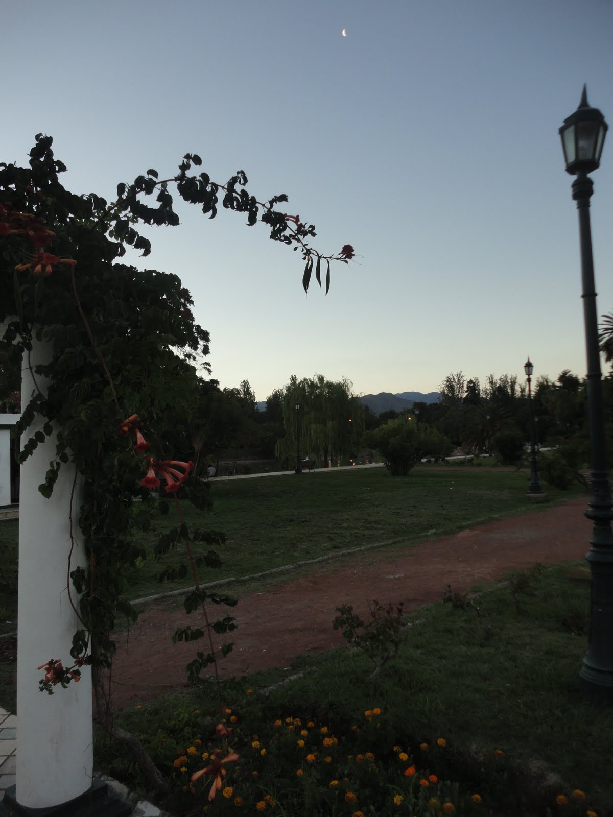
After the fabulous bus ride across the Andes, we arrived in Mendoza, Argentina, mid-afternoon, on the southeast edge of town. Mendoza itself is a growing city smack in the middle of the famous wine country in the rain shadow east of the Andes.
I had arranged lodging in the Maipu region of wine country for the next few days, but we wanted at least a couple days to explore the city itself before heading off to the vineyards. Since we decided to spend a day here, we needed to find lodging for the night.
Wandering around aimlessly in the heat, with our backpacks on, looking for lodging, is not Jessica's favourite game -- I've learned that one before! On the map, Mendoza looked easy enough to navigate. It has some parallels to Ft. Collins, being a flat, compact city with foothills to the West; and a population in the low 100k's as a center of other surrounding populated areas.
We were approached immediately when arriving by a middle-aged, chain-smoking woman representing Hostel Suites Mendoza, with pictures in a binder. The deal was that you'd get free transportation there and then you'd get a room. It would be convenient, and the price seemed right at $40 for a private room, but risky to commit without seeing it in person, so I memorized the address and thought we could walk that general direction.
First, thought, I went to stop at an ATM in the bus station, only to find out it wasn't working. Same thing with the other one in the station. No Argentinian pesos on my person yet, but I figured I'd find one later.
I must have chosen poorly on our route toward the center of town, as I didn't find too many hostels, including one listed in our guidebook that didn't exist at that location.
So we did find ourselves at the Hostel Suites Mendoza anyway -- and saw a few other options nearby. We checked out Hostel Suites first.
It seemed decent enough, and it would be better than wasting more time looking around, so we decided to go with it. Unfortunately, as is often the case with hostels such as this, the relative inability of the friendly but youthful staff to rationally multi-task or efficiently service customers meant that we took 45-50 minutes just for this process.
One benefit of this hostel was free internet via wireless or 4 computers, which would have been nice to use while waiting. Typical public computer etiquette -- often this is posted -- is 10 minutes while people are waiting. Instead, a coven of 4 girls refreshed their Facebook pages and sent inane messages to their friends.
I haven't used Facebook since November, but this experience was an added reason. (Digression: We had also just seen "The Social Network" on the plane for the first time, and I also hated Facebook even more after watching that, mostly because of all the hype about the movie, which already had me thinking about how the reason people liked it is mostly because they like Facebook and feel apart of it, so they feel like it's a movie about them, which is the biggest experiment in social solipsism in history.
We weren't the oldest clientele by far, but between my frustration at the staff as well as youth in general (remember, there's a timeshift abroad where our 21-year olds are their 18-year olds), at that moment I officially felt old.
And I'm OK with that.
While waiting, I asked where the nearest ATM was, since foreign currency and credit cards (though accepted) had an extra charge. Plus, I like to minimize the potential for funny business and/or incompetence when it comes to credit card usage abroad.
I found out there was a bank of ATMs 4-5 blocks away, so I left J with the bags and ran out to get cash. I saw a couple of banks with lines of people, strangely, but found an ATM and cursed the uniform surcharge (~4.50/transaction, regardless of amount) while getting cash.
I arrived back at the Hostel with no apparent progress, but eventually we were able to check in.
Our room was modestly small, but had an air conditioner, as well as the space-saving, coveted bidet-shower combo (All Things Clean, All At Once!)

With a load off our backs, we were finally able to go out exploring.
Argentina generally, and Mendoza specifically, has a historic Italian influence via immigration. Interestingly, you can here slight affects of Italian in the spoken language itself. But that also meant there were fabulous opportunities for pizza and ice cream, in addition to wine and beer:


Along Paseo Sarmiento, like many other parts of town, you can't go wrong with pizza at an outdoor cafe
After a lingering meal, we headed further west in the waning daylight through a few parks, to the large Parque General San Martin at the west edge of town. This was a refreshing circuit of crushed gravel and paved paths, trees, and lakes. Lots of folks were out strolling, jogging, or rollerblading, and kids were out playing as well (as common as it is to eat late every night, it is also common for kids to be out playing regularly at 10 or 11pm).
We walked around the park and then headed back at night. There is a significant amount of nightlife in Mendoza, but we didn't explore that. Instead, we had expectedly fitful sleep in our room with various clans of youth heading out, loudly. But, no bed bugs, which is our top request, and the air conditioner did drown out some of the noise.
Morning Run
I finally got up early enough for a morning run. The youth were deathly silent at 8AM! I headed back toward the park, which I read opened at 8:30.
Traffic was lighter, and the sun was still low enough that the leafier trees kept the temperature down.
I enjoyed a flat run on the gravel paths, almost imperceptibly climbing upward as I headed west, and nodded at a few other runners. The trees ended and it was noticeably hotter as I left the western edge of the park, and passed a very cool bike velodrome. I expected to make a loop in the park, but my plans changed when I reached the western edge and saw an obvious nearby cerro poking up toward the sky.
This turned out to be Cerro de la Gloria, which had a twisting road that led to the top with great views and a wicked statue commemorating San Martin himself. There were also different trees and several pools along the way, and great views of the city to the east, and the foothills and Andes to the west. Desafortunadamente, I didn't have my camera with me...
On the way down, I was startled to see some white deer, only to realize that it was the zoo!
The day was quickly becoming hotter, and I had drained my one bottle of water in just over an hour as I came back and woke up J. But I felt significantly better after getting out in the morning.
Now we had that tenuous situation where we wanted to walk around some more during the day, but also check out of the hotel. They had a baggage area downstairs but warned about lack of liability and monitoring. We debated, but J said "You have to trust people to some degree or you can't travel at all" and that was good enough for me. I had a cable lock so it was unlikely that our entire packs would be stolen, but our stinky clothes were technically fair game.
We headed out to a cafe to grab some coffee and light breakfast (the hostel breakfast was coffee-less and didn't look overly appertizing). I still had some cash left over, but was again looking for an ATM, especially since I figured they would be scarcer once we left the city. But the only ones I saw, strangely, had long lines, so we just headed to the cafe.
Picture from the night before:

We had very friendly service and some great coffee, and some newspapers were laying around, so I glanced casually. The main section specifically caught my eye, and as I read the article slowly, I was beginning to piece things together.
New money was being reprinted since November and December, but due to printing issues, the government switched from a printer in Chile to one in Brazil. Mainly this affected 100 peso bills (~$25), which are the common denomination in ATMs. The money then has to go to Buenos Aires before being distributed out to Mendoza. This was delayed, so there was a shortage of cash in Mendoza ATM's. Plus, they just had a holiday season in which people withdrew more money than usual. And they have a low limit of 400 pesos/day at most ATMs, coupled with the surcharge, so most people withdraw 400 at a time. Which is, of course, 4 100-peso notes.
There were specific stories of people being unable to get cash for the weekend; some folks getting the wrong denomination; and other people that were traveling and having a hard time getting cash.
That was us. I was low on cash and unsure if I'd be able to get more. (Since I returned, I read that Mendoza has approximately 100 less ATMs than it could/should have based on usage). I also vaguely recalled some sort of Argentinian money crisis earlier in the decade. This was the 2001 riots in which 26 people died, as runaway inflation and other fears led to people withdrawing large sums of cash and perpetuating the cycle.
I didn't want to be overly dramatic, and didn't know if it was overblown in the newspaper, but with another week in Argentina, I didn't know what to expect.
So our next, critical order of business, was to find a bank or ATM.
Wednesday, February 16, 2011
New BQ Times
New qualifying times and system for the Boston Marathon.
* Every standard is 5 minutes faster, starting in 2013.
* "On the first two days, only runners who have bested the qualifying time by at least 20 minutes will be allowed to apply. On days three and four, those who have beaten it by 10 minutes can apply. On day five, five minutes." (Then everybody else with a qualifying time)
Time chart on BAA website.
***
Likely to be some complaints (doesn't address disparities between specific groups), but it goes toward fixing what seemed like a broken system this year. It's also neat to think about how it will spread out bubbles of runners (young men and women at 3:10 and 3:40, respectively) at other races, as runners work hard towards 5 and 10-minute buffers.
Sunday, February 13, 2011
Winter Shermanator

Mt. Sherman, 14036 ft
2850ft gain from Leavick Site
Hike/Ski
I had been wanting to summit and ski something high this winter, but most weekends had either bitter cold, snow, or both. Finally, this weekend shaped up to be sunny and warmer, albeit still with high winds in the mountains. The previous couple days had settled the recent snowpack somewhat, but avalanche danger was still "Considerable" on the CAIC website. I opted to check out Mt. Sherman, as I had some familiarity with the different route options and some ideas on how to avoid the riskiest avalanche terrain (namely, the cornice on the saddle towards Sheridan). Also, it is generally pedestrian and considered "easy" in the summer, so it is correspondingly crowded; ironically, this is the only one J and I turned around on due to snow and wind in November.
I brought my skis. The real 14er ski studs are pretty adamant about skiing from the summit, but I was going to see how far up/down I could get.
I went up solo, though when parking at the Leavick site, I met a group of 4 on snowshoes and their dog. They were going to evaluate either avoiding the cornice to the right of the standard route, or heading up White Ridge. I had the same ideas in mind, and headed off up the road, glad to have some company in the vicinity, though we never met up for the rest of the day.
But there were also mountain goats:

The wind was steadily direct straight at me as I hiked up past the lower mines and the cabin. Here, I evaluated my options. White Ridge had less snow and would be an easier hike on foot -- ultimately the other party took that route. Otherwise, there was a continuous layer of thin snow from the summit, but I didn't know how stable it was. There was more mellow snow and scree to the climber's right of the cornice. I decided to take this route up so I could evaluate the snow options for the decent.
However, I made slow progress up toward the ridge as the wind intensified. The skis were a liability, as they would catch any gust and twist me sideways. I could only imagine it being more difficult on the ridge. Plus, I wasn't overly enthusiastic about skiing solo on variable snow in windy conditions anyway, so I stashed the skis halfway up.
Climbing without the skis was remarkably easier. I was glad to have my ax with me for some of the steeper pitches, as well as Microspikes which fit nicely over my boots. Finally, I reached the ridge, which was as windy as advertised, a constant jet engine roaring in my ears.
By staying on the back side of the ridge, of course, it was easier to stay upright in the wind. Occasionally, I crossed back onto the top, and a gust would knock me down to my knees again.

Finally, I got over the false summit, and then onto the summit itself. By lying flat on my back, I could escape most of the wind. I had some great banana bread and still-warm coffee!
Now I headed back down the ridge, as carefully as before, and then back down to my skis. Downclimbing in the wind was even more disconcerting as heading up. I finally reached my skis, but didn't have a good spot to put them down, so I ended up downclimbing further until I was in solid but mellow-angle snow just above the cabin.
Finally, I was able to use the skis and wind to my advantage, as the road and creek below the upper cabin were a solid layer of skiable snow.
So I didn't get to ski anywhere near the summit, but still enjoyed a winter hike with mixed climbing and skiing. Just hiking above the cabin would have been much faster, but the ski down was considerably faster and more enjoyable than walking. This is even a good spot for a mellow ski or snowshoe outing, as I saw a couple of other folks doing, without heading to the summit.
Frostbite? Windburn?
Although I made great time up and back to the cabin, I took more time in between, and ended up back at the car after 5.5 hours. I was glad to relax and get out of the wind.
At some point later -- not immediately -- my watch felt somewhat uncomfortable, so I took it off. I was unpleasantly surprised to find that it was swollen and sore underneath. Within minutes, literally, a dime-sized patch of purple formed on the bony protrusion at the end of my ulna. Not 10 minutes later, that patch disappeared, as it turned bluish-white, though remained swollen. Remembering back, I had fallen lightly while skiing and landed on my wrists, though it wasn't that unusual; and, my gloves and clothing don't fully cover my wrists from the wind if I'm not careful.
A few hours later, it looked more like a swollen bruise -- nowhere near as nasty as most of the frostbite pictures online, but still out of the ordinary. That area of skin still has full sensation.
By the next day, a thin, jagged purple line appeared across the top of my wrist. I can move my wrist in any direction, pain-free, but bumping the bruise is painful.
Even stranger, the wife 'encouraged' me to shave. When I did, I noticed some reddish-purple, slightly painful blotches under my chin(!). I had a facemask on all day, and thought I did a good job of keeping everything covered and warm (my fingers and toes felt fine all day). However, I also had my ski helmet on, and I even buckled it at some point.

The only full explanation I can come up with is that the elevation induced some swelling which constricted bloodflow further at my watchband and helmet strap, made even worse in areas that had some exposure to the cold and high wind. Perhaps I had some trauma to my wrist from falling at some point, but the lack of bloodflow prevented proper inflammation and some of the blood kind of pooled there, only to disperse later.
That's all I can think of on another weird and obscure injury, but yes, more lessons to be learned. Glad to be on the summit of a mountain, but looking forward to warmer, non-windy days!
EDIT: This sounds more and more like windburn, based on some reading online. The skin is quite dry, and it's likely that somehow the sweat and constriction from my watch and having that wrist uncovered more may have affected it. There is also a small patch (much less dramatic) on my right wrist as well. But it appears to be healing somewhat.
Tuesday, February 8, 2011
Lakewood Green Mountain Ski
Looking to get some quick play in the snow, I snuck over to Green Mountain in Lakewood.
Although it's a popular area, and looks like fun from mtnrunner's writeups, it was actually my first time there. I suspected, from the snow totals, that the morning after would have enough snow before it melted/got trampled.
But, many of the more urban trails only get enough snow a handful of times in the winter, which isn't enough to list it in any guidebooks or anything, so you don't know what to expect unless you try it. (And you're best to stick to buff non-rocky trails).
I wasn't disappointed in the amount of snow, and I was happy not to have to drive any further on unplowed roads.

One of the drawbacks of many Front Range foothills trails is (admittedly necessary) urban blight from radio towers and antennae. However, on a day like today when the snow and fog roll through, you barely see it!

I started from the first trailhead coming off Alameda, and rolled along the ridge for about an hour. Some of it was actual work in fresh snow. I gave into the temptation to drop off of the trail, hoping not to get stinkeye from the locals, but it turns out that the snow was *too* powdery and it wasn't quite steep enough for my skinny skis. I did see one other fellow hiking up with alpine skis!
So the best part was actually staying on the trail, and it got better when I turned around and the snow was packed down from my own line as well as some snowshoers. The only real fun downhill was actually the 2 switchbacks down to the parking lot, so I went up and down that a few times.
So yes, after a fresh snowfall, it's enough for a quick little rolling tour if you get out there right away!
Winter Running Updates
Some thoughts on winter running as I've had to mix it up a bit.

Trail
* Snuck out to Bobcat Ridge in the Fort, one of my favorites, while up visiting for the Super Bowl. Some extra work in ankle-deep powder and drifts on the back, but also saw an elk herd there for the first time (for me).
Dreadmill
* Broke my silly Colorado non-treadmill streak (almost 5 years) and total non-treadmill streak (5 or 6, not sure) last week on the coldest/icy days. To be fair (or rationalize), I did run and/or ride outside those same days to get to school (slow-speed slip on the ice during one bike ride), but wasn't as motivated to charge through the varying slop at road crossings. I don't like wasting external energy *while* I'm exercising on a treadmill, but driving a couple hours to go to the mountains also isn't planet-friendly, so hopefully nobody's gonna call me on this and other readily-apparent hypocrisies and nonsense.
* Nice to have treadmill available in our apartment workout room, but I can't get over being incredibly bored. Listened to some science podcasts in order to multi-task. I see the attraction when you want to be home and keep an eye on kids, though. I'll lean towards buying rollers for the bike though when it comes to that so I don't have to plug anything in.
Stretching
* Been stretching more to keep the groin/hip/leg in check. Better than before, but not perfect. Stretching isn't making it worse, so begrudgingly it seems like a good idea for now.
Vertical
* Stairs: My work building is 12 stories, but has a narrow, tight set of stairs that leave me dizzy and with a burning throat at the top. Across the way is a 9-story building, with wider concrete stairs and natural light. This has been a great option and I'm working on incorporating it semi-regularly. Takes me almost exactly a minute, slams the heart rate while keeping me honest on leg power and foot placement.
Did a bit of reading on the whole sport -- interesting sub-culture of racing with its own stars and techniques. One recent set of results has recognizable names like Ricky Gates winning and Mock in the Top 5, and Samantha Sigle for the ladies, so being good at stairs seems to correlate with other races. Is it causal, though? Who knows, but for a convenient winter workout, I'll take it!
Pack Win

Chicken brats boiled in beer, then perfectly grilled by brother-in-law, who despite being a Vikings fan graciously hosted us with their new TV.
Good stuff!
Tuesday, February 1, 2011
The Chilean Hitchhiker, and the Terremoto Race Against Time
J was already in the car, and as I walked towards it, I knew the question.
"Are you guys headed down the canyon?" he asked*.
(* Everything's in Spanish)
"Yes."
"Could I get a ride?"
"Um, let me ask my wife." He followed me up as I asked her.
I had explained to her previously how common hitchhiking was, especially in the rural areas, but I didn't want to push us relying on it to get around. This was different, though. Reluctantly (but also ready to fall asleep), she said "Yes."
I told him my name, Miguel, and asked his. He stiffened, pressed out his chest, and let out a long stream of family names and surnames. Sounded good enough to me, so we headed down the canyon.
"I'm only heading to San Alfonso, though."
"No problema."
So we chatted, and his occasional English was pretty good. Actually, as good or better than my Spanish, I had thought, but he demurred. He didn't think he could survive in the U.S. or other English-speaking country without knowing more English.
"You'd be surprised," I told him, "you can get by pretty well in California."
He had been hiking up in the canyon, and enjoyed doing that on weekends. He lived just outside of the canyon and worked in Santiago, in comunicacion quimica, as we both discovered we had interests in the biological/scientific fields. He asked what we had done in Chile so far and what else we planned to do (I downplayed our imminent departure to Argentina). He said we had seen most of the highlights in Santiago itself. I said we were headed to the coast for a day-trip, we were thinking of Valparaiso.
"I don't recommend it, it's even more peligroso than Santiago." Instead, he recommended the town of Maitencillo. Desafortunadamente it was 2.5 hours from Santiago, and we didn't make it there, but it was a solid recommendation. (And we did make it to Valparaiso...which wasn't that great).
I asked, and he told me, about some of the mining features, rivers, and small towns as we headed down the canyon. He asked if we had heard about the miners, and I told him how much of the U.S. was riveted by the television coverage of the rescue, even though it was the middle of the night. He also asked if I had heard about the earthquake (terremoto) the week before, and something else clicked in his mind.
"What have you had to drink in Chile?"
I told him about different wines, and visiting Concha y Toro, and how we really enjoyed the great wine which would have been much more expensive in the U.S., in addition to different beers I had tried.
"Have you had a terremoto?" He smiled.
"No, what's that?"
I don't remember what his actual answer was, but he insisted I had to have one. I asked if they would have it up in the canyon, but he said I would only be able to find it in the city...but that I had to try it.
Soon enough, we were near our lodge, where I dropped him off and we wished each other buen viaje.
***
The next day was to be our last full day in Chile. We returned the rental car in Santiago, and took an hourlong bus ride to Valparaiso. Although I know we could have headed further up the coast for better beaches and surfing, the fact that we spent time in the mountains precluded us from doing so. This way, we at least got to see the ocean, but with an uninspiring backdrop of a faded city (despite being a UNESCO World Heritage Site) under a grey sky.
However, we did get to appreciate how all that cheap fruit gets to U.S. grocery stores:

By the time we returned, we only had a few hours left for our last evening in Santiago. We headed back to Providencia, and again enjoyed a long meal with wine. Before we knew it, it was 11:30PM, and things were starting to slow down, despite guidebook assurances that things are hopping late pretty much every night.
It was then I remembered the terremoto.
"No, sorry, we don't have them here."
I asked who might have them. He gave vague answers about general areas where I could go manana.
"Pero es mi ultima noche en Santiago y my amigo dice que necesito que beber un terremoto!" Somehow my desperation mixed with inebriation, and this all made sense.
"Ah!", he replied, "there is a place close by, I think." He went inside, then returned with directions. "Yes, just go down here a few blocks, and on the corner..."
I thanked him, and we headed to that bar. They were closing up, too, and picking up chairs from the patio.
"Sorry, we're closing soon, so we don't have dinner anymore."
"Do you have terremoto?" I asked him.
"Sorry, maybe tomorrow...we don't have helado..." (I didn't know how ice cream was related to this).
"Pero es mi ultima noche en Santiago y my amigo dice que necesito que beber un terremoto!"
He perked up, told us to wait, and headed inside. Just a few minutes later, he came back with a distinct concoction, which he placed on the table proudly.
"Un terremoto!"
He told us what was in it: Pineapple ice cream, white wine, and Jager(!). (Looking online since returning, it seems that the Jager was a unique twist).
J and I shared it: it was otherwise a smooth, sweet cocktail, that would have been more appropriate mid-day, but it was nice to finish the quest nonetheless.
I thanked -- and tipped -- him profusely, glad to get one last taste of Santiago before heading over to Argentina.
Subscribe to:
Posts (Atom)