Showing posts with label 12er. Show all posts

Sunday, September 9, 2012

A Circle Tour of the Circle Peaks in RMNP


Peaks shown from Trail Ridge, picture from Summitpost.

Mt. Ida
Chief Cheley
Pt. 12820
Cracktop
Mt. Julian
Terra Tomah Mountain (12718')
~14.5M, 6000' gain, 8 hours

When recently visiting the high point of Trail Ridge Road, our view was drawn to some of the peaks just off of the Continental Divide, especially Mt. Julian (the most visually prominent of the peaks). It was apparent that these peaks can be connected for a nice long ridge run, and internet research suggested that the route would be fairly easy, with a combination of Class 1 runnable trail, much Class 2, and a bit of Class 3, with the bulk of the route above treeline. When we factored in another pleasant weather forecast, Nick, Steph, and I were up for a Rocky Mountain adventure.

Our goal included 6 peaks, and is described as the "Circle Peaks" and "Gorge Lakes Peaks" for the respective cirque formed by the mountains around Gorge Lakes. Our proposed route involved a fairly straightforward ascent of Mt. Ida, followed by a ridge run all the way out to Terra Tomah, followed by backtracking and some possibly different descent options once in the field. All 3 of us had the Trails Illustrated RMNP with us, but we could just has easily brought postage stamps with us instead.


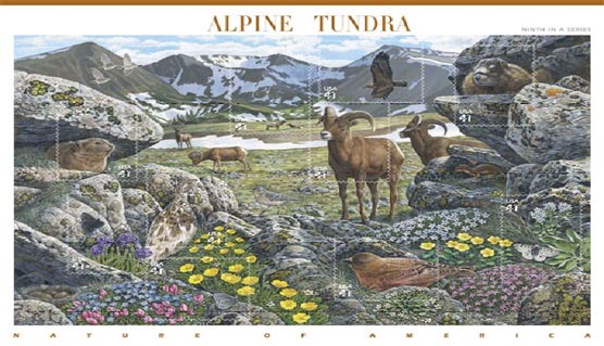
Indeed, these peaks are so visually stunning, they were an inspiration for a USPS "Alpine Tundra" stamp.

By first light, we had crossed the high points of Trail Ridge on Iceberg and Milner Passes, descending to Poudre Lake, where we started our journey.
The first peak was Mt. Ida, a flat summit that slopes gently toward the divide. In that respect, and more, there are similarities between Ida and Flat Top mountain in RMNP, as both have runnable trails over 4 miles each way to the summit. The trail to Ida isn't marked on all maps, but is definitely a pleasure to hike or run.
I am unsure of Ida's naming, although that mountain name is prominent in Greek mythology.

We gained Ida with steady hiking in just over 80 minutes, and now had view towards Chief Cheley Peak, which had a more satisfying and accessible summit. (For anyone considering a hike of Mt. Ida, it's definitely worth it to add on a summit of Chief Cheley).

Pics courtesy of Steph and Nick

In the short approach to Chief Cheley, we had enough time to ponder the naming of the peak. We guessed a Native American heritage, but looks like we missed on that one. Instead, Chief Cheley Peak is named after Frank H. Cheley, who was known for directing a boy's camp in Michigan, Camp Eberhardt, in the 1910's. He authored several books based on these experiences, and in "The Three Rivers Kids", he included himself as a character known as "The Chief." He soon established himself in Colorado by opening the Bear Lake Trail School in 1921, an outdoor school for boys, and then later expanding to inclusion of a girl's camp as well. The Cheley Colorado Camps exist today. I am curious for further explanation and clarification, especially to know if the actual naming of the peak was based on exploration or honorifics, as the founding of the park predates Cheley's founding of the school in 1921.

After Chief Cheley, there's a ridge with a highpoint of 12820', rolling along directly to Cracktop. Both names are obvious, with Cracktop being named by a vertical slit directly at the summit.

The ridge between Cracktop and Julian is the slowest-going because of more technical terrain, but still remains Class 3 with easy routefinding.

Afterward, we headed to the more prominent summit of Julian, our penultimate named summit, to be followed by Terra Tomah. I've since learned the explanations for these mountain names (as well as reaching the same conclusions on Ida and Cheley) from "Best Summit Hikes in Colorado", with Julian being named after civil engineer and surveyor Julian Hayden. It appears he did some exploration around the area, but other information about Mr. Hayden is scant. It is likely that official Larimer County surveyor Abner Sprague named it simply in Julian's honour, but I am unaware if the imposing nearby Hayden Spire is named after Julian or more famous surveyor F.V. Hayden.

Terra Tomah's explanation is a double misnomer, as it appears to be a mondegreen from a Cohuila ghost dance...but the name was intended for the lake instead, and was mistakenly applied to the mountain.
(In any case, it's a fun name to play with: it also anagrams to "A Rat Mother..." whatever that means).


Mt. Terra Tomah (left) and Mt. Julian (right)


Julian went quickly enough, and was the only summit with a register, and soon enough we were exploring Terra Tomah's flat summit (with a few candidate high points).

Now we were ready for a decision: most routes involve backtracking the way we came. Doable, but loops are always more satisfying. We had another option of backtracking about halfway before descending to trails parallel to Trail Ridge. But, as we stood on Terra Tomah (and having seen it earlier), we thought that descending off of it would be a fun way to explore the lower lakes and benches above them, and lead to a satisfying loop. But would a Terra Tomah face descent go?


We could see parts of the route, and we were aware of some towers, but it looked like we could descend safely, both in terms of the terrain we could see, and by having ramps leading in either direction at the points we could not. We gambled, fully prepared to reclimb and count our losses, and although it was slow and loose (with occasional slabs of granite, sometimes helpful and sometimes too smooth and vertical) I'd say it was a fun descent that kept our attention. Although there was occasional backtracking,we fanned out and took slightly different routes down, suggesting that there were options.

Our descent off of Terra Tomah's East Face, roughly in the middle

Looking back gave us a new appreciation for the mountain, for what appeared to be a non-descript flat summit from the ridge ended up having a quite impressive face. Going down this face added legimitacy to this mountain, in this author's opinion. In hindsight, an easier but longer option would have been to drop off the more gentle South slopes. Also, photographs show that the lower reaches of Terra Tomah often hold snow in the area we traversed, but was dry on the August day in a very dry snow year of 2012.

Now our technical difficulties were over, and we needed to regain elevation as we explored the lakes below. We gained the bench between Arrowhead and Love lakes on solid rock, as we approached an outlet cascade. This is indeed the source of the Big Thompson, a powerful river that has carved out the canyon all the way from Estes to Loveland.

At this point, though, 'twas but a trickle and a jump:


After a brief blitz through willows, we had straightforward options of regaining the ridge to complete the loop. It was a breathless, Euro-hiking grunt, we made it back out of the cirque. Except, there was more elevation to gain as we traced back along the ridge to the Ida trail, which added to the grind.

Finally, we were back to the trail, and it was a fun, clean descent back to the car. In all, I think the Circle Tour of the Circle Peaks was a great route, and it was great to enjoy it with fun and capable friends.

Desolation Peaks RMNP


From 2012-August Desolation Peaks Loop


Marmot Pt. (11,909')
West Desolation (12,918')
East Desolation (12,949')

Nick and I decided to check out a peak-bagging loop focused on the Desolation Peaks in RMNP. He has a more detailed writeup, but essentially we started at the Alpine Visitor's Center, shamelessly grabbed Marmot Point (a high 11er) before skirting along the Mummy Range to hit the Desolation Peaks.

The Desolation Peaks are lesser-visited high 12ers, shyly hiding behind the Mummy's, but more jagged and pointy than the rounder neighbours. The 2 peaks are connected by a jagged, talus ridge, with the East peak being slightly higher. Fun, exposed views await those who venture here.

Unfortunately, with the exposure and significant time above treeline, weather can often be a factor. We had a decently typical forecast, and even with developing clouds, we thought the broken, blue skies in the distance would be sufficient to give us time, after a 10AM summit of East Desolation.

Soon enough, Nick felt his hair sticking up -- so that's what the shaggy ultra-mane is all about, it's a lightning detector! -- and as we descended, within seconds we heard a giant crack (more like an explosion) directly above us.

On the face of it, being on a ridge wouldn't be ideal, but it turns out the ridge has a depth of features not found on the rest of the route. Along a vertical granite wall on East Desolation, we scrambled underneath talus, which formed a rather protective and comfortable cave. We waited for 45 minutes and were relatively sheltered from rain and graupel. The close lightning seemed to be an outlier, as most other thunder rumbles were more distant, with no imminent cloud-ground flashes seen.

We killed time by making a video:

Desolation Peaks - Cave during Storm from mike hinterberg on Vimeo.


Other reports talked about exposed, loose talus on the ridge -- we were not looking forward to this, with the newly added factors of nearby storms added to wet rock (with some accumulated graupel). But being scarcely 10 minutes away, and comfortable with "Desolation Cave" as a retreat point, we emerged from the cave to examine the ridge.

Even while wet, the ridge was far more stable and enjoyable than I had read. I found the large talus forming East Desolation to be generally trustworthy and solid, both climbing and downclimbing, with great exposed views. I was motivated to move quickly because of weather, trying to get into a zone of steady climbing, and found that cracks on the climber's right of the peak provided reliable passage.

East Desolation Peak climb from mike hinterberg on Vimeo.


We retreated safely to East Desolation, with rain threatening but no further evidence of storms. Still, we played it safe by descending off of East Desolation towards the Poudre River, into the forest. Now we were relatively sheltered from weather, but spent the next hour in a longer-than-expected bushwhack.

We (meaning Nick) had initial plans of climbing a lame, forested hump of a hill that had sufficient statistics to be a ranked Larimer Peak. My interest piqued a bit when learning that it had a nickname of "Nutcracker Peak," which somehow made it more interesting than "Pt. 10855" -- but with another forested bushwhack ahead of us, we called it a day. Mercifully, the return to Trail Ridge was uneventful in terms of weather, and was more lightly-forested.

Monday, August 13, 2012

Quick Mayflower Pilgrimage: Crystal Peak and Mayflower Hill


Crystal Peak (13852')
Mayflower Hill (12416')


After Brandon's Saturday night Leadville Run, and another great day of weather in the mountains, Nick and I, along with Andy Gisler, decided to take advantage of another mellow running/hiking opportunity before wrapping up the weekend.
First, though, we watched a replay of the women's Olympic Marathon race, drank some coffee, and hung out a bit, before finally ambling out to the mountains just before noon. But what a leisurely Sunday!

On tap was a ridge run Centennial 13er combo of Atlantic and Pacific ("Coast-to-Coast") combined with Crystal Peak. In just over 8.5 miles, we'd have a short run/hike into the lovely Mayflower Gulch, and then a straightforward Class 2 hike up to the Crystal-Atlantic saddle, before hitting C-P-A. I've enjoyed visiting the gulch previously in winter. The weather was cooperating, and we were all game for jogging and power hiking after the previous day's near-40 miles at elevation.

At least, I thought I was.

After just over 10 minutes on the trail, we bushwhacked across the creek, finding relatively easy passage through the willows and into the trees, onto the shoulder of Mayflower Hill. Skirting below it, we continued onto larger talus fields and then sidehilled below Pacific's summit, eventually getting below the Pacific-Crystal saddle. We headed up the saddle, which had one false summit lump and some impressive notchy views from the top:


And then headed up to the Crystal summit.

Somewhere along the way, though, the previous day..2 days...week's training caught up with me. Standing with both feet on a large rock, I felt it wobble, only to look down and see that it was completely stationary. My legs were not too achey, but were shaking on the rocks, and my head was swimming a bit. Not sure if one was causing the other. I ate some extra food, not feeling hungry or otherwise low on calories, but it didn't make it better. I could still move fine, just slowly. By the time I caught up at the Crystal summit, I told the guys that I was going to head down while they continued. I hated having to bail -- especially on a particular route I was excited to do -- and watched enviously as they headed up towards the cool looking notch on the top of Pacific Peak. But I knew I reached my limit for the week. If I were solo, I could have gone slower and/or taken a nap, but with group dynamics I had crossed the line from being slow to being a potential liability if I pushed anything harder (since I knew the route down was easy and would only get easier).

After a bit, though, it was actually kind of cool to watch 2 red dots proceed upward on the mountain, and track their progress. I took my time heading down off of Crystal as I kept watching their progress to Pacific. Soon enough, they disappeared around the other side.

I headed down deliberately off of Crystal, and a bit lower off of the talus and onto the tundra. Some wildflowers were still showing, and I began to feel better, enough to jog along the tundra towards the rockier saddle of Mayflower Hill. I got closer to another group that had descended off of Pacific, but I was below them near the Mayflower Saddle, so I headed up towards them. In hindsight, the quickest way is to stay low along the Pacific Creek drainage and only really climb below the Mayflower-Pacific saddle and Pacific-Crystal saddle -- essentially what Roach suggests in the 13er book.

Taking my time along the tundra and boulder fields, I was able to appreciate small details that I normally don't, such as some of the striped and smoother rocks along the creek, impressive larger pieces of quartz, and some igneous rocks as well. Along the boulders, I had to be careful, especially at face level(!), for spiders that cast a single tripwire between rocks; once the line was disturbed, the bulbous spiders dropped quickly to the ground and scurried away.

I was feeling better by the time I re-climbed the Mayflower Saddle, and I had a clear view of Atlantic. Scanning the ridge, I finally made out 2 dots just coming off of the summit, with another pair just about off of the ridge. I was happy to know of their success and being able to estimate their arrival time, so to make lemonade out of my otherwise single-summit, I made the extra effort to head up to the summit of Mayflower Hill. And, man, the 13ers are getting crowded too -- why not enjoy an uncrowded 12er?


The Hill has a faint trail on top, and a few candidate cairns vying for true summit status. I enjoyed the views from the top, knowing that I could either retreat the way I came, or ride the ridge as long as possible towards the highway. I chose the latter, and had a nice easy jog across tundra. Before dropping to treeline, I stayed high on some balder patches of grass, wanting to drop into the forest as late as possible. I feared a bit of a slog in the last 3/4 mile or so, but it turned out to be a pleasant surprise of occasionaly game trails, logging road, well-spaced trees, and otherwise clean forest floor that was relatively free of detritus. That is, it was possible to zig-zag and jog down through the trees, headed toward the highway and parking lot. I wouldn't be able to retrace these steps on an ascent, but I'd definitely recommend considering it for a return route.

I was still early enough to chat with a guy in the parking lot about various hikes, and get some beers ready for the other guys. In short order, everyone was back. I need to return for some Coast-to-Coast action another time, but was happy to have enjoyed the views from Crystal and Mayflower.

Monday, September 12, 2011

Rawah Lakes and Peaks: Rawah Peak Traverse


Sheep Mountain (Rawahs) (11820')
S. Rawah Pk (12644')
N. Rawah Pk (12473')
~20 mile trail circuit from West Branch TH
Plus ~5 Miles for peakbagging (1 RT for Sheep, 4 RT for Rawah Peaks)

*

With summer waning, I had been looking for something in the high country before the snow settled in. I decided on taking a trip to the Rawah's, to attempt a route connecting some of the region's lakes and highpoints.

For scheduling reasons, I ended up doing this solo, and since the trip was exploratory with some unknown route connections, this ended up working out pretty well, as I was able to take my time (and then some), as I wouldn't sure how it would turn out. Mainly, I began with the framework of a semi-classic clockwise loop route starting from the West Branch Trailhead, which goes past the numbered Rawah Lakes (#1-#4) and numerous other named alpine lakes. This loop is generally done as a multi-day backpacking trip, but contains good trail for a 19.3 mile circuit. To this, I added a short but 0.6 mile (roundtrip) spur towards Crater Lakes, which I had read that led to an opening with a view of the surrounding mountains, but was unnecessary since I later achieved the same views.

To this basic route, I intended on adding some Rawah peak-bagging as well; namely, 12ers North and South Rawah Peaks. There is some limited beta on these peaks, but I had one more goal in mind: explore the connecting ridge between the 2 peaks for a natural traverse. Additionally, I would gain views to the South for future connections of the ridge that leads to the monarch of the range, 12951' Clark Peak. I've hiked to Clark with J on a long but beautiful approach from Blue Lake, and was intrigued to see new reaches of the range to the north.

So after a pre-sunrise drive up the Poudre Canyon under a nearly full moon, I was ready to tackle the loop on a gorgeous September day. My car thermometer read 31 degrees as I headed out along the Laramie River. The trail crosses the river and quickly heads into the trees, where it steadily gains elevation along the west branch of the river. Interspersed among the trees, even this late in the year, were blooming yellow, purple, and white wildflowers. The underbrush was changing to amber, and the aspens will be sure to follow in the coming weeks.

After a few miles, I headed due west along the Rawah Trail. As I mentioned, I headed briefly up the North Fork/Crater Lakes trail for a snack break and my first views of the mountains, but shortly after returning to the Rawah Trail, several open meadows afforded mountain views which would be persistent above treeline. Bench Lake was the first lake visible to the west, and South Rawah Peak made its first appearance. There were clearly several climbable options along the east and southeast ridges of South Rawah, but I had a plan to continue to the trail's highpoint of Grassy Pass.


The trail above treeline was in fantastic shape. I had been making good time, so I couldn't help but notice Sheep Mountain just off the right side of the trail. It was a named peak and would be quick work, so I decided to climb it and use the vantage point for further viewing of the Rawah connecting ridge. This is also suggested for anybody with the desire to climb all 45 peaks named "Sheep Mountain" in Colorado!

Climbing up Sheep Mountain is an easy tundra walk, but begins with a bit of scrambling through willows on a lower shoulder of the peak. Fortunately, there are sufficient game trails scattered throughout the willows, so it doesn't take long to get through the willows and head directly up the peak.


This was an easy diversion but worth it for the views of the imposing ridge above Rawah Lake #4. I was reminded of the Comanche-Fall headwall.


Heading directly southwest of Sheep Mountain, back down over Grassy Pass, leads up to a natural approach to a saddle between S. Rawah Peak and Pt 12484'. This is easy, grassy tundra that was also blessed with hues of a brilliant pinkish-red flowers and scrub.


Interspersed among the tundra are short sections of talus-hopping, and maneuvering around small pockets of water. This late in the year, feet can be kept dry if you're careful.


Near the top is an avoidable snowfield, just below a lower summit bump which can be avoided. Finally, the top of South Rawah Peak provides distance views to the South.

The tallest peak along the ridge is Clark Peak, with its prominent Northeast Ridge. At this time I am convinced that the Blue Lakes approach to Clark remains the classic one: the southeast side of the ridge is more gentle and approachable (with some interesting Class 2+ on the top of the ridge), and in the summer there are sparkling lakes connected by rushing streams, fields of wildflowers, and short opportunities for glissading.
From my vantage point on S. Rawah, one could certainly scale each of the humps in succession from Clark Peak to North Rawah, but it would be a very long day (e.g., the Summer Solstice!) or multiday adventure, with backpacking down at the lakes. There are occasional rocky sections that look manageable but would slow down the traverse. Now that I know, I am not as intrigued by a lengthy ridge run in that direction. Instead, future investigations will likely involve running the ridge from the Diamond Peaks side instead.

I looked around the S. Rawah Pk summit, and found obvious cairns but no summit register. After a quick snack, I headed north, again skirting the useless hump before the top of headwall, to contemplate my fate.

This was to be the crux of the route, and had me both anxious and excited. I had seen no pictures of this section and read no direct reports on it (although based on brief Summitpost listings, I know people have traversed it). I am not an overly experienced scrambler, so I was looking forward to the challenge, yet keeping it within my abilities. If at any point I could not proceed safely, I would certainly turn around; and I would additionally monitor any committing moves to ensure that I could turn around easily.

The other information I was relying on is based on previous observations of the area:
* The face is dramatic and erodes sharply, but the hills to the West are more gradual, and this configuration is typical (e.g. Comanche-Fall). It appeared steep on the map but not a knife edge.
* The rock on that side of the Poudre is solid (which is in stark contrast to Richtofen, Mahler, Static Peak, Nokhu Crags, etc. on the other side).
* Rocky sections in the Rawahs are generally larger boulders, whereas large slabs and big scree piles are more rare.


Consequently, the first view of the connecting ridge was a relief.
The northern half of the traverse was safe tundra, reminiscent of the Comanche Wilderness, so only the southern half was actually scrambling. The lower part of the slope was looser, but up on top the rocks were large and stable enough to suggest a choice of routes.


In the middle were two larger rockpiles. These were manageable as well, and terrain was similar behind them. The key was to stay as high as possible, and although some of the rocks were large enough for fun friction climbing, no sections required a completely exposed climb.


Once the rocks gave way to tundra, it was easy to stand near the edge and peer below. With a few hundred feet of easy gain on tundra, the lumpy peak of N. Rawah is obtained.


Again, I found cairns and a small summit shelter at the top, but no summit log.
After a lunch break, it was time to descend. I had spotted at least two decent alternatives on the view below (retreating slightly towards the saddle to the south of the peak, then descending; or continuing north along the ridge, before descending to one of the lakes further up on the trail), but inexplicably choose neither. I headed straight for the trail to scope it out. It steeply drops off, but it seemed manageable, so I headed down. It was loose and steep, and although it wasn't a horrible option, it was slow and not entirely fun. There were just enough rocks and occasional vegetation to grab a handhold, but you needed to test every single hold, and it was easy to send rocks below (albeit with clear visibility of the fact that nobody is down there). This would be really slow with more than one person due to the instability of the rocks, so I strongly suggest backtracking slightly and descending around the snowfield to the south of the peak.


Now the peakbagging session was over, which took probably 4 hours itself with lunch/picture breaks, and it was back to the trail. It would have been quicker to return via the West Branch/Rawah Trail, but I wanted to complete the loop. After scooting north around the shoulder of Sheep Mountain, this meant heading past some more lakes, including a criss-crossing intersection of loops near the Sandbar Lakes. A sign pointed left and right, respectively, to the 2 lakes, but the trail also continued (after briefly disappearing) straight ahead, which corresponded to the easternly direction of my goal. This is the desired trail as it heads towards Camp Lake.

Oh, I had just encountered two backpackers: the first people I'd seen in six hours.

The trail is now back into the trees. A sign describes the intersection of Camp Lake and a spur trail to Upper Camp Lake. Camp Lake itself is larger and serene, but not as glorious as the alpine lakes already seen. Now the trail becomes very faint in boggy marshland around the lake. Some logs and small bridges are placed in particularly troublesome spots, but if you head in the general direction of the sign, the trail picks up again.

Alternatives on the return loop
One thought of a more direct loop that still includes Sheep Mountain: the trail itself now isn't as exciting, so climbing Sheep Mountain on the return, descending to Upper Camp Lake (if a less-steep route with minimal bushwhacking is possible), and then dropping down to Camp Lake on the trail would be a good alternative. Simply put, there isn't otherwise a really strong argument for climbing Sheep Mountain by itself.

But don't be fooled by the Trails Illustrated map if you think you can stay above treeline even longer and hit the trail further east! I had mistakenly thought that the brown colouring is above treeline, and green is forested. This is mostly true, but the actual meaning (as depicted in the legend) is unforested versus forested. The key point here is that unforested, in this area particularly, can mean bogs and marshes! So sticking only to known alpine, or known trails, is the safest and fastest route.

But I had chosen to stick to the trail, so now I was on the Camp Lake section for awhile. I was a bit tired from the rest of the day, so I was just trying to get done. The trail is still lovely but the lakes and waterfalls are prettier on the bottom/West Branch part of the loop instead. The only interesting new development here is, for a few miles, the trail is actually along a ditch that was developed and abandoned some years ago.


This provides an interesting change and a bit of relief from running on rocks and walking sideways on tundra. It would be a fantastic cross-country ski trail -- too bad it would require a few hours on rocky terrain just to reach it; or a very fun bike trail -- but the Wilderness regulations preclude such usage. As it is, it's an interesting smooth trail in the middle of nowhere.

After a few miles of slightly rolling terrain, the descent finally begins. And goes on and on and on. The map doesn't have the resolution to show the dozens of switchbacks through the woods, but it gets monotonous and tiresome. Well, it's still a beautiful area, but I mismanaged my distance estimates because I didn't consider the switchbacks. So given a single choice, West Branch is the better one for a shorter, prettier approach to Grassy Pass (if not Crater Lakes) and the peaks above. But it's hard to beat a loop for seeing 20+ miles of different terrain!

I finally reached the car, over 9 hours since I started. My estimates were 6-8 hours, but adding the extra Sheep Mountain trip (30 minutes), a slow descent off of N Rawah, and accumulated fatigue added up.

Northern Colorado Classic?
Already a classic backpacking and fishing destination, for running (all singletrack!) and scenery, this loop is a classic running route as well. It's hard to compete with something like with the Maroon Bells Loop, and I still haven't done Pawnee-Buchanan, but it belongs on an extended list with routes like Comanche-Fall (Comanche Wilderness), Flat Top-Hallett-Otis-Taylor, and Comanche-Venable (Sangres). I'll also add the unheralded Zimmerman-Thunder Pass loop across the street. For pure running, the trails themselves on the main circuit are in great condition and relatively easy to follow. The traverse between the peaks is a scrambling challenge, but it's on solid rock with great views. And, for whatever it's worth, I saw 5 people all day on a perfect Sunday!

For the peakbagging experience as well, I'd suggest a few minor tweaks:
* Climb S. Rawah further south, either from Bench Lake, or even nearer to Crater Lakes (giving a good excuse to take that spur trail), rather than backtracking from Grassy Pass. This is described elsewhere as the East Ridge route.
* When descending N. Rawah, retreat slightly to the saddle and descend around the snowfield
* Consider a return approach that goes above Sheep Mtn. and descends to Upper Camp Lake

If you've been up there or have different ideas, let me know. The Cameron Pass area is a fantastic area to explore year round!

Sunday, September 11, 2011

Monday, August 29, 2011

A Wyoming High: Medicine Bow Peak and Sugar Loaf Mountain


Medicine Bow Pk 12013'
Sugarloaf Mtn 11398'
7.5 Mile loop (CW) from Lake Marie
~3.75hrs RT w/ Caleb

The border between Colorado and Wyoming is a fully human concept, set at the 41st parallel. Notwithstanding the Wind River Range, Tetons, and Bighorns in Northern Wyoming, most of Southern Wyoming generally gets the shaft in terms of terrific alpine scenery.

Except, that is, for the Medicine Bow Peak massif in the Snowy Range of Southern Wyoming. With trailheads above 10000 feet and just off of the paved Highway 130, Medicine Bow Peak is an instantly accessible alpine high.

And what a high indeed! Numerous well-stocked alpine lakes, streams, and giant granite boulders dot the landscape. Wildflowers burst with color, lupine and Columbines alike, the Colorado state flower itself knows no boundaries. And, this never gets too old: snowfields in August!


We strolled steadily up the back side of Medicine Bow Pk, taking our time getting distracted by the stone remains of a cabin, and heading off trail occasionally to peer over the edge to the lakes below. Solid cracks led up obvious climbing routes, and scrambled along some short sections.

The infamous Wyoming wind was not to be found on this glorious day, as we made our way to the summit, where we saw maybe 8 or so other people.
Obligatory summit shot:


Obligatory summit-with-ridiculous-belt-buckle-shot:


Heading down off the mountain, on a loop to the east, leads to a trail that switchbacks and descends quickly, to a saddle with Sugarloaf Mountain. This lesser peak (labeled below from an earlier view) has an interesting enough prominence to make a short Class 2 scramble to the top worthwhile:


Etymological Digression
"Sugarloaf" is a name that refers to numerous mountains and hills around the world, from Brazil to Winona, Minnesota. This refers to the shape of a block of sugar, that used to have a long, conical shape for shipping and storage purposes.

When a person wanted a bit of sugar, he would simply cut a chunk off. Incidentally, the tool used for this is called "sugar nips."

Entomological Digression
Caleb mentioned a friend who was recently recovering from a brown recluse spider bite (ugh!). This led to a discussion of which insects we would remove from existence if given the choice. In a limited list including spiders, wasps, and the pine beetle, Caleb unselfishly chose the pine beetle. But when expanded to other insects, he easily chose the annoying horsefly. I hate horseflies as much as anyone, but suggested the mosquito, so as to reduce malaria and dengue fever. However, Caleb pointed out that I hadn't been specific about species, since when thinking about mosquitos, we were first thinking about the annoying but non-deadly familiar kind (Aves Minnesotus)...and if we wiped out horseflies, would we wipe out all flies? Considering the advances in scientific understanding of evolutionary development we've gained from the fruit fly, Drosophila melanogaster, I hope not.

But I digress.
*
Sugarloaf was a quick, fun diversion that gave us great views back toward Medicine Bow Peak. Now we headed down along a ridge and eventually hit the rest of the loop trail, where even more wildflowers and great views awaited.

All too quickly, we reached the shores of Lake Marie again, where schools of small trout darted out of the weeds each time our shadow cast a reflection.

This area is an easy 2-hour drive from Fort Collins, and is absolutely stunning. Even short walks and picnics along the shore would be worthwhile. More trails to nearby lakes deserve further exploration, as well as an intriguing canyon on the other side of the road.

Finally, this trail would be a great running loop as well. Start early to avoid crowds, and I would suggest going counterclockwise (opposite of our direction) to start the busier part of the trail in the trees earlier, and then climb up the rockier switchbacks, before enjoying a smooth descent along the plateau of the peak.

Tuesday, September 28, 2010

Kenosha Peak


"Kenosha Peak" 12,100 feet.
9 miles / 2300' gain RT from South Ben Tyler trail (campground at bottom of hill)
~5 hours total (30 min on summit)

Sunday, 19 September.

Mid-September, time to see some aspen.
This is our 5th Colorado autumn, and I don't think I'll ever get over it. The cool, crisp air; infinitely blue skies; and blazing yellow aspen on the mountainsides. I guess I missed this season altogether when we lived in San Diego, so I don't take it for granted anymore. Otherwise, folks rave about the palette of colour back East. I'm not inclined to disagree, and certainly enjoyed that growing up in Wisconsin, but for my money, I'll still take the Colorado gold.

Unfortunately, with school and all, we're limited to day-trips. One of the most reliable spots closer to Denver is the Kenosha Mountains (coincidentally named with a Wisconsin connection). I've enjoyed the famous Kenosha-to-Georgia pass mt. bike ride a few years ago in October, after the leaves had mostly fallen as well as a dusting of snow. This time, we'd head into the Lost Creek Wilderness for a leisurely day-hike. I knew that this area held lots of potential for easy travel on long above-treeline ridges in relative solitude, so I was anxious to get to explore.

J, along with friends Ben and Bailey, were looking for a day-trip hike of similar caliber, so it worked out well for us to head up on a glorious morning.

The first stop was Kenosha Pass itself:


Then, over the pass, around that glorious curve of Hwy 285 south of the pass (I had a friend remark once how he enjoyed that section of road, and having thought the same thing, I now wonder how many other people can picture what I'm talking about), we soon hit Lost Park Rd, new terrain of dirt road heading east.

The road was passable in the Outback, probably doable in a slow 2WD car, but I was grateful for sufficient clearance in some of the ruts. At one point, the car was tipped pretty far sideways and everyone leaned in the opposite direction, but it takes a lot to tip a car over. Right?

Headed up, and up, with some great views to the West.


Anyway, we stopped at the campground about a half mile from the TH. Good parking (and camping) spot. Headed up the road, then onto the trail. The trail was easy to follow, mostly buff with a few creek crossings. There were some interesting bouldering opportunities early, so definitely worth spending some time here. Otherwise, through the forest, up a short, steeper section of switchbacks, and then above treeline, with a thicket of willows to the right of the trail.

To get to "Kenosha Pk", leave the trail just after the views open up after the switchbacks. As suggested on Summitpost, heading further up the trail, then arcing back uphill makes it easier to avoid most of the willows. There's a small ridge that does exactly that, so it's easy to head for the ridge and follow it up to the Peak.


This is an open expanse of tundra with great views and a long ridge of other peaks in each direction. Yes, this is a great ridge run, and many have done exactly that. In our case, we hadn't seen anyone on our way up to the top.

We had a leisurely snack break at the top:


On the way back down, we went more directly through the willows, as it was easy to see the trail intersection, and there were numerous game trails winding through them.

Going back down, Ben and I impatiently ran the switchbacks and some other fun stuff. In short, this whole trail is eminently runnable. If you wanted to run, some great options would be an out-and-back on the Ben Tyler trail (note that the Northern TH is very easy to get to, closer to Denver and right off of Hwy 285), as well as off-trail ridge run possibilities.

We saw 2 parties on our way down, on a glorious day. Oh, at the bottom was a family having a picnic near their truck, right at the trailhead. An aluminum can (can't remember if it was beer or soda now, though it would be a better story if it were beer so I should just say that) was sitting right in the middle of the trail, and a young boy at the bottom was doing...something. After we passed, he resumed: shooting at the can with a BB gun. Now I know the (lack of) power of a BB gun, I grew up with guns and have enjoyed shooting in the past, so I'm not an irrational gun-phobe, but this just seemed like, uh, one of those teachable moments (even though they were armed). I mean, shooting up a trail of all things? So I quietly asked Dad if he thought it might be a better idea to shoot in a different direction (Rule #1: Don't tell some dude what to do. Rule #2: Don't chew him out in front of his family)...luckily he agreed and asked little Johnny to move the can. Phew.

Anyway, a great hike in an uncrowded area, avoiding I-70 altogether. Of course, I had to stop and take more pictures on the way out, because the aspen look different in the light at different times of day...