Our first view of the Larimer County High Park wildfire was from Wyoming.
Mike R., Nick, and I were returning from a race in Laramie, heading towards a plume of smoke to the South. Our initial guesses were that part of the Hewlett fire had flared back up. Although the plume was prominent, it appeared to be compact, and deep in National Forest land.
As we got closer to town, we then noticed that the fire was indeed further south -- the top of Rist Canyon.
The footprint was larger, as well -- not just because we were closer, but because the winds had very likely doubled the fire in size in the mere hour it took us to drive down.


With hot, dry temperatures, and steady winds, conditions were looking ripe for the fire to spread further. And it did.
Early Sunday morning, we had another run planned. Slush, Sarah, and I drove up to Nick's house at 5:30, driving west into an eerie and thick blanket of fog-like smoke. Dedicated and foolish in our running at times, none of us were willing to run in those conditions. It was our hope that the air would be clearer in the Big Thompson canyon to the South, where we planned to run.
Several fire vehicles flew past as we drove up toward Masonville, and we saw a few sheriff's vehicles at the mouth of Redstone Canyon. We stopped to get an update. The officer in charge, with a great deal of adrenaline and stress in his voice, told us that Redstone was being evacuated; the fire was moving quickly and unpredictably; and the fire was completely uncontrolled. We remained optimistic that the fire wouldn't move too far South, towards Nick's place, but the fire and smoke and the fact that there's only one real escape road (also necessary for fire traffic) very well could lead to evacuations up there. (And it did, later that night, before being allowed back in Tuesday afternoon).
By the afternoon, the fire had exploded and moved even further East.
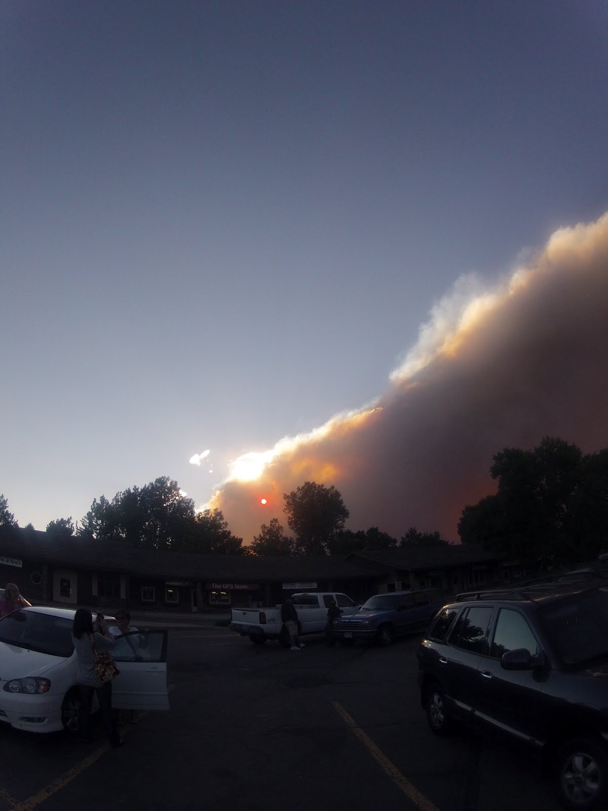
On an otherwise blue-sky day, a giant cloud of smoke enveloped town.


By Monday, the fire crested ridges above Lory State Park, so flames were now visible in town. I drove up last night to check it out, without getting any really good pictures, but being dismayed by the sight of a line of flames snaking down the hill. The dam roads were all closed, and traffic was heavy and chaotic with other folks out checking out the fire.
We can't help it -- besides a natural curiosity about fire, we're all worried about the people and homes and the land itself. As it stands, it's difficult to imagine that some of our beloved places -- peaks that I was on just a few months ago, canyon roads that are popular for cycling and others for running, and trails that we raced on just last month, will never be the same.
Even west metro Denver was covered with smoke this AM, and it smelled like someone forgot to open the chimney damper.
ReplyDeleteI was up in Wild Basin on Saturday, and the billow of smoke over the ridges looked like a pale-colored volcanic eruption. Ominous.
Sad about parks, homes and life lost. Wondered about Nick's place.
Just catching up from afar/out-of-state on what's happening up there. Scary and sad.
ReplyDeleteVery sad watching what's going on up in the Fort.
ReplyDeletePretty sure Nick's section/south Horsetooth Res was allowed to return back at noon today.
ReplyDelete